Back أزكابوتزالكو Arabic Azcapotzalco (lungsod) CEB Azcapotzalco German Azcapotzalco (Meksiko) EO Azcapotzalco Spanish Azcapotzalco EU Azcapotzalco Finnish Azcapotzalco French Azcapotzalco GA Azcapotzalco Hungarian
Azcapotzalco | |
|---|---|
|
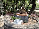
Top: Azcapotzalco Avenue; Middle: Santa María Malinalco Chapel, Independence Heroes Monument; Bottom: Tézomoc Park, Azcapotzalco Culture House | |
 Azcapotzalco within Mexico City | |
| Coordinates: 19°28′20″N 99°11′00″W / 19.47222°N 99.18333°W | |
| Country | Mexico |
| Federal entity | Mexico City |
| Established | 1928 |
| Named for | Ancient Tepanec city |
| Seat | Av. Castilla Oriente s/n esq. 22 de Febrero |
| Government | |
| • Mayor | Margarita Saldaña Márquez (PAN) |
| Area | |
• Total | 33.69 km2 (13.01 sq mi) |
| Elevation | 2,252 m (7,388 ft) |
| Population (2020).[1] | |
• Total | 432,205 |
| • Density | 13,000/km2 (33,000/sq mi) |
| Time zone | UTC-6 (Zona Centro) |
| Postal codes | 02000–02999 |
| Area code | 55 |
| HDI (2020) | |
| Website | [1] |
Azcapotzalco (Classical Nahuatl: Āzcapōtzalco Nahuatl pronunciation: [aːskapoːˈt͡saɬko] ⓘ, Spanish pronunciation: [askapoˈtsalko] ⓘ, from āzcapōtzalli “anthill” + -co “place”; literally, “In the place of the anthills”) is a borough (demarcación territorial) in Mexico City.[3] Azcapotzalco is in the northwestern part of Mexico City.
The town began in the pre-Hispanic era and was the seat of the Tepanec dominion until the Aztec Triple Alliance overthrew it. After that it was a rural farming area becoming part of the Federal District of Mexico City in the mid-19th century. In the 20th century the area was engulfed by the urban sprawl of Mexico City. Today it is 100% urbanized and is a center of industry.
- ^ a b c "Principales Resultados del Censo de Vivienda y Población 2020" (PDF) (in Spanish). Retrieved October 17, 2023.
- ^ "Base de datos del IDS-2020". Consejo de Evaluación de la Ciudad de México.
- ^ Agren, David (29 January 2015). "Mexico City officially changes its name to – Mexico City". The Guardian. Retrieved 30 January 2016.


