Back بانت ARZ Bant CEB بانت FA Bant Finnish Bant French Bant FY Bant (plaats) Dutch Bant Polish Бант (Нідерланди) Ukrainian Bant (chng) ZH-MIN-NAN
This article needs additional citations for verification. (November 2020) |
Bant | |
|---|---|
 Street view | |
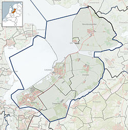
Location of Bant in the province of Flevoland | |
| Coordinates: 52°46′9″N 5°45′0″E / 52.76917°N 5.75000°E | |
| Country | Netherlands |
| Province | Flevoland |
| Municipality | Noordoostpolder |
| Established | 1951 |
| Area | |
• Total | 39.99 km2 (15.44 sq mi) |
| Elevation | −3.5 m (−11.5 ft) |
| Population (2021)[1] | |
• Total | 1,495 |
| • Density | 37/km2 (97/sq mi) |
| Time zone | UTC+1 (CET) |
| • Summer (DST) | UTC+2 (CEST) |
| Postcode | 8314 |
| Area code | 0527 |
Bant is one of the so-called green villages (Dutch: groendorpen) in the Dutch province of Flevoland. It is a part of the municipality of Noordoostpolder, and lies about 7 km north of Emmeloord.
- ^ a b "Kerncijfers wijken en buurten 2021". Central Bureau of Statistics. Retrieved 12 April 2022.
- ^ "Postcodetool for 8314AA". Actueel Hoogtebestand Nederland (in Dutch). Het Waterschapshuis. Retrieved 16 December 2015.


