Our website is made possible by displaying online advertisements to our visitors.
Please consider supporting us by disabling your ad blocker.
Bombarral
Bombarral | |
|---|---|
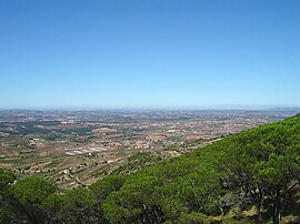
 The view from the Serra de Montejunto, overlooking Bombarral | |
 | |
| Coordinates: 39°16′5″N 9°9′19″W / 39.26806°N 9.15528°W | |
| Country | |
| Region | Oeste e Vale do Tejo |
| Intermunic. comm. | Oeste |
| District | Leiria |
| Parishes | 4 |
| Government | |
| • President | José Manuel Vieira |
| Area | |
• Total | 91.29 km2 (35.25 sq mi) |
| Elevation | 34 m (112 ft) |
| Population (2011) | |
• Total | 13,193 |
| • Density | 140/km2 (370/sq mi) |
| Time zone | UTC+00:00 (WET) |
| • Summer (DST) | UTC+01:00 (WEST) |
| Postal code | 2540 |
| Area code | 262 |
| Patron | São Pedro |
| Website | http://www.cm-bombarral.pt/ |
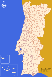
Bombarral (Portuguese pronunciation: [bõbɐˈʁal] ⓘ) is a portuguese municipality in the Oeste region, historical province of Estremadura, and the Leiria district. The population in 2011 was 13,193,[1] in an area of 91.29 square kilometres (35.25 sq mi).[2] It includes four civil parishes (Portuguese: freguesia) that provide local services.
- ^ Instituto Nacional de Estatística
- ^ "Áreas das freguesias, concelhos, distritos e país". Archived from the original on 2018-11-05. Retrieved 2018-11-05.
Previous Page Next Page


