Back بويانوفاتس Arabic Буяновац Bulgarian Буяновац CE Bujanovac Czech Bujanovac German Μπουγιάνοβατς Greek Bujanovac Spanish بوجانوواچ FA Bujanovac French Bujanovac Croatian
Bujanovac
| |
|---|---|
Town and municipality | |
Building in the center Bujanovac Mosque Sezai Suroi Gymnasium Railway station | |
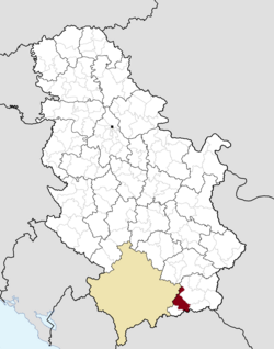
 Location of the municipality of Bujanovac within Serbia | |
| Coordinates: 42°28′N 21°46′E / 42.467°N 21.767°E | |
| Country | |
| Region | Southern and Eastern Serbia |
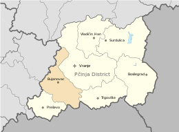
| District | Pčinja |
| Settlements | 59 |
| Government | |
| • Mayor | Nagip Arifi |
| Area | |
| • Town | 8.95 km2 (3.46 sq mi) |
| • Municipality | 461 km2 (178 sq mi) |
| Elevation | 384 m (1,260 ft) |
| Population (2022 census)[3] | |
| • Town | 11,468 |
| • Town density | 1,300/km2 (3,300/sq mi) |
| • Municipality | 41,068 |
| • Municipality density | 89/km2 (230/sq mi) |
| Time zone | UTC+1 (CET) |
| • Summer (DST) | UTC+2 (CEST) |
| Postal code | 17520 |
| Area code | +381(0)17 |
| Car plates | BU |
| Website | www |

Bujanovac (Serbian Cyrillic: Бујановац, pronounced [bǔjanɔvats]; Albanian: Bujanoc) is a town and municipality located in the Pčinja District of southern Serbia. As of the 2022 census, the municipality has a population of 41,068.[4]
Situated in the South Morava basin, it is located in the geographical area known as Preševo Valley. It is also known for its source of mineral water and spa town Bujanovačka banja. Ethnically, Serbs are the largest ethnic group in the town, while the largest ethnic group in the municipality are Albanians.
- ^ "Municipalities of Serbia, 2006". Statistical Office of Serbia. Retrieved 28 November 2010.
- ^ "Насеља општине Бујановац" (PDF). stat.gov.rs (in Serbian). Statistical Office of Serbia. Archived from the original (PDF) on 14 November 2015. Retrieved 22 October 2019.
- ^ "Prvi rezultati Popisa stanovništva, domaćinstava i stanova 2022". stat.gov.rs (in Serbian). 21 December 2022. Retrieved 16 February 2023.
d
- ^ "2022 Census of Population, Households and Dwellings" (PDF). Retrieved 7 December 2023.


