Our website is made possible by displaying online advertisements to our visitors.
Please consider supporting us by disabling your ad blocker.
Derwentside
| Derwentside | |
|---|---|
 Shown within non-metropolitan County Durham | |
| Area | |
| • 1974[1] | 66,944 acres (270.91 km2) |
| Population | |
| • 1973[1] | 91,460 |
| • 1992[2] | 87,200 |
| • 2001[3] | 85,074 |
| History | |
| • Created | 1974 |
| • Abolished | 2009 |
| • Succeeded by | County Durham |
| Status | District |
| ONS code | 20UD |
| Government | Durham County Council |
| • HQ | Consett |
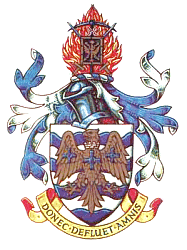
| • Motto | Donec Defluet Amnis (Until the river ceases to flow) |
 | |
Derwentside was, from 1974 to 2009, a local government district in County Durham, England.
The district took its name from the River Derwent, which made up part of the northern border of the district. Its main towns were Consett and Stanley, with the district council offices on Consett's Medomsley Road. The rest of the district was semi-rural, with numerous former pit villages running into one another.
- ^ a b Local government in England and Wales: A Guide to the New System. London: HMSO. 1974. p. 46. ISBN 0-11-750847-0.
- ^ Office of Population and Census Studies Key Population and Vital statistics 1992
- ^ "Derwentside". Census 2001. Office for National Statistics. Retrieved 19 April 2009.
Previous Page Next Page


