Back Kaartinkaupunki CEB Kaartinkaupunki Czech Kaartinkaupunki Danish Kaartinkaupunki German Kaartinkaupunki ET کارتینکااوپونکی FA Kaartinkaupunki Finnish Kaartinkaupunki French Kaartinkaupunki Dutch Каартинкаупунки Russian
This article relies largely or entirely on a single source. (March 2022) |
Kaartinkaupunki
Gardesstaden | |
|---|---|
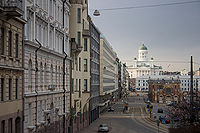
 Vanha kauppahalli on the right and the Helsinki Cathedral in the background | |
 Position of Kaartinkaupunki within Helsinki | |
| Country | |
| Region | Uusimaa |
| Sub-region | Greater Helsinki |
| Municipality | Helsinki |
| District | Southern |
| Subdivision regions | none |
Area | 0.33 km2 (0.13 sq mi) |
| Population (2013) | 999 |
| • Density | 2,291/km2 (5,930/sq mi) |
| Postal codes | 00130 |
| Subdivision number | 03 |
| Neighbouring subdivisions | |
Kaartinkaupunki (Finnish pronunciation: [ˈkɑːrtinˌkɑu̯puŋki], Swedish: Gardesstaden) is a neighbourhood in the southern part of Helsinki, Finland.


Kaartinkaupunki consists of the area between the Esplanadi park and the Tähtitornin vuori park. Its area was first confirmed in 1812, but the neighbourhood was only named in 1959. It is neighbourhood number 3 in Helsinki, belonging to the Ullanlinna district and to the Southern main district. Kaartinkaupunki was named after the old Russian army barracks located near Kasarmitori. The oldest part of the barracks was built in 1822. It was originally built as a residence for the Helsinki training battalion, which later became the Guard of Finland.
The neighbourhood has a land area of 0.33 square kilometres (0.13 sq mi). In 2005, it had a population of 881, and in late 2003, it had 11,001 jobs.
Kaartinkaupunki includes the Esplanadi park, the Helsinki Market Square, and the streets of Pohjois- and Etelä-Esplanadi. It does not include any of the buildings on Pohjoisesplanadi, because they belong to Kruununhaka or Kluuvi. One of the main streets in the area is Korkeavuorenkatu. The precise location of the neighbourhood can be seen on the Helsinki city plan map.