Back Karibib AF كاريبيب ARZ Karibib (lungsod) CEB Karibib German Distrito electoral de Karibib Spanish Karibib Finnish Karibib French Karibib Italian ಕರಿಬಿಬ್ KN 카리비브 Korean
Karibib
Otjiherero: Otjandjomboimwe | |
|---|---|
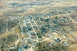
 Karibib aerial view 2017 | |
 | |
| Coordinates: 21°56′17″S 15°51′16″E / 21.93806°S 15.85444°E | |
| Country | |
| Region | Erongo Region |
| Constituency | Karibib Constituency |
| Founded | 1900 |
| Government | |
| • Mayor | Dawid Iipinge[1] |
| Population (2023)[2] | |
• Total | 8,434 |
| Time zone | UTC+2 (South African Standard Time) |
| Climate | BWh |

Karibib (Otjiherero: Otjandjomboimwe) is a town in the Erongo Region of western Namibia. It has 8,434 inhabitants. Karibib is the district capital of the Karibib electoral constituency. It is situated on the Khan River, halfway between Windhoek and Swakopmund on the B2 (Trans-Kalahari Highway), the main road between Walvis Bay and Johannesburg. The town is known for its aragonite marble quarries and the Navachab Gold Mine.
- ^ "Four towns re-elect mayors". The Namibian. NAMPA. 9 December 2013. Archived from the original on 11 December 2013. Retrieved 9 December 2013.
- ^ Cite error: The named reference
nsa2023was invoked but never defined (see the help page).
