Our website is made possible by displaying online advertisements to our visitors.
Please consider supporting us by disabling your ad blocker.
Kidapawan
Kidapawan | |
|---|---|
 | |
 Mapa de Cotabato con Kidapawan resaltado | |
 | |
| Coordinates: 7°0'29.99"N, 125°5'21.98"E | |
| Nación | Filipinas |
| Región | Soccsksargen (Región XII) |
| Provincia | Cotabato |
| Número de barangay | 40 |
| Fundación | 18 Agosto 1947 |
| Gobierno | |
| • Type | Sangguniang Panlungsod |
| • Electorado | 91 167 votantes (9 Mayo 2022) |
| Area | |
• Total | 358,47 kilómetro cuadrado km2 (Formatting error: invalid input when rounding sq mi) |
| Elevation | 491 metro m (Bad rounding hereFormatting error: invalid input when rounding ft) |
| Population (1 Mayo 2020) | |
• Total | 160 791 |
| • Hogares | 39 891 |
| Economía | |
| • Clase de ingresos | es un tercera clase de ciudad |
| • Incidencia de la pobreza | 20,83 |
| • Ingresos | ₱ 226,7 million (2020) |
| • Activos | ₱ 1863 million (2020) |
| • Pasivos | ₱ 652,4 million (2020) |
| • Gastos | ₱ 915,8 million (2020) |
| Time zone | UTC+8 (PST) |
| Código postal | 9400 |
| PSGC | |
| Código telefonico | 64 |
| Clima | clima ecuatorial |
| Lenguaje nativo | hiligaíno Cebuano Tagabawa Obo Ilianen Tagalog |
| Website | http://kidapawancity.gov.ph/ |
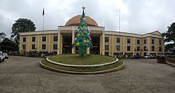
Kidapawan es un tercera clase de ciudad na provincia de Cotabato, [[Filipinas]]. Tiene este zona de 358.47 kilómetro cuadrado kilometro cuadrado. Comporme del 1 Mayo 2020 censo este tiene papulidad de 160,791 personas y 39,891 hogares. El designada codigo postal 9400 y PSGC 124704000.
- ↑
"Province: North Cotabato". PSGC Interactive. Quezon City, Philippines: Philippine Statistics Authority. Retrieved Diciembre 17, 2016.
{{cite web}}: Check date values in:|accessdate=(help) - ↑ "PSA Releases the 2021 City and Municipal Level Poverty Estimates". Autoridad de Estadística de Filipinas. 2 Abril 2024. Retrieved 28 Abril 2024.
Previous Page Next Page


