Our website is made possible by displaying online advertisements to our visitors.
Please consider supporting us by disabling your ad blocker.
Leerdam
Leerdam | |
|---|---|
City and former municipality | |
 City walls and Glass Centre | |
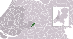
 Location of the former municipality in South Holland | |
| Coordinates: 51°54′N 5°6′E / 51.900°N 5.100°E | |
| Country | Netherlands |
| Province | Utrecht |
| Municipality | Vijfheerenlanden |
| Merged | 2019 |
| Population | |
• Total | 21,000 |
| Demonym | Leerdammer |
| Time zone | UTC+1 (CET) |
| • Summer (DST) | UTC+2 (CEST) |
| Postcode | 4140–4145, 4163 |
| Area code | 0345 |

Leerdam (Dutch: [leːrˈdɑm] ⓘ) is a city and former municipality in the western Netherlands, in the province of Utrecht. The municipality was merged with the municipalities of Vianen and Zederik on 1 January 2019. The name of the new municipality is Vijfheerenlanden which is a part of the province Utrecht. The former municipality Leerdam was a part of the province South Holland.
The south border of the town is formed by the river Linge. The name originates from a dam in the river Lede which was a branch from the river Linge towards Meerkerk. Leerdam is situated almost exactly in the middle of the three highways A2, A15, and A27.
Previous Page Next Page


