Our website is made possible by displaying online advertisements to our visitors.
Please consider supporting us by disabling your ad blocker.
Lehua
| Lehua | |||||
| Géographie | |||||
|---|---|---|---|---|---|
| Pays | |||||
| Archipel | Hawaï | ||||
| Localisation | Océan Pacifique | ||||
| Coordonnées | 22° 01′ 12″ N, 160° 05′ 51″ O | ||||
| Superficie | 1,03 km2 | ||||
| Administration | |||||
| État | Hawaï | ||||
| Comté | Kauai | ||||
| Démographie | |||||
| Population | Aucun habitant (2012) | ||||
| Autres informations | |||||
| Géolocalisation sur la carte : Hawaï
Géolocalisation sur la carte : archipel d'Hawaï
Géolocalisation sur la carte : Océanie
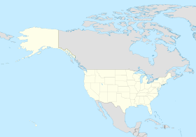
Géolocalisation sur la carte : États-Unis
| |||||
| Île aux États-Unis | |||||
| modifier |
|||||
Lehua est une petite île en forme de croissant située à 1,1 km au nord de Ni'ihau. L'île elle-même était formée d'un cône de cendres relié au volcan éteint de Ni'ihau.
Lehua était l'une des cinq premières îles découvertes par le capitaine James Cook en 1778, qu'il avait orthographié "Oreehoua"[1].
- ↑ (en) John Galt, All the Voyages Round the World: From the First by Magellan, in 1520, to that of Freycinet, in 1820, W.H. Colyer, (lire en ligne)
Previous Page Next Page


