Our website is made possible by displaying online advertisements to our visitors.
Please consider supporting us by disabling your ad blocker.
Maheshtala
Maheshtala | |
|---|---|
 Maheshtala Municipality | |
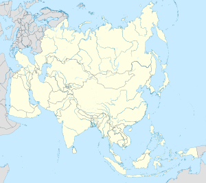
 Interactive map outlining Maheshtala | |
| Coordinates: 22°30′22″N 88°15′01″E / 22.5060294°N 88.2501665°E | |
| Country | |
| State | |
| Division | Presidency |
| District | South 24 Parganas |
| Government | |
| • Type | Municipality |
| • Body | Maheshtala Municipality |
| Area | |
• Total | 44.18 km2 (17.06 sq mi) |
| Elevation | 7 m (23 ft) |
| Population (2011) | |
• Total | 448,317 |
| • Density | 10,000/km2 (26,000/sq mi) |
| Demographics | |
| • Literacy | 82.03 per cent |
| • Sex ratio | 952 ♂/♀ |
| Languages | |
| • Official | Bengali[1][2] |
| • Additional official | English[1] |
| Time zone | UTC+5:30 (IST) |
| PIN | 700018, 700024, 700044, 700060, 700061, 700063, 700066, 700082, 700088, 700104, 700139, 700140, 700141, 700142, 700143 |
| Telephone code | +91 33 |
| Vehicle registration | WB-19, WB-20, WB-95, WB-96, WB-97, WB-98 |
| Lok Sabha constituency | Diamond Harbour |
| Vidhan Sabha constituency | Maheshtala, Metiaburuz |
| Website | www |
Maheshtala (Bengali: [mɔɦeːʃt̪ɔlɑː]) is a city and a municipality of the South 24 Parganas district in the Indian state of West Bengal. It is a part of the area covered by Kolkata Metropolitan Development Authority (KMDA).[3]
- ^ a b "Fact and Figures". Wb.gov.in. Retrieved 5 July 2019.
- ^ "52nd Report of the Commissioner for Linguistic Minorities in India" (PDF). Nclm.nic.in. Ministry of Minority Affairs. p. 85. Archived from the original (PDF) on 25 May 2017. Retrieved 5 July 2019.
- ^ "Base Map of Kolkata Metropolitan Area". Kolkata Metropolitan Development Authority. Archived from the original on 28 September 2007. Retrieved 3 September 2007.
Previous Page Next Page


