Our website is made possible by displaying online advertisements to our visitors.
Please consider supporting us by disabling your ad blocker.
Ottenschlag
Ottenschlag | |
|---|---|
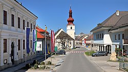
 Center of Ottenschlag | |
| Coordinates: 48°25′00″N 15°13′00″E / 48.41667°N 15.21667°E | |
| Country | Austria |
| State | Lower Austria |
| District | Zwettl |
| Government | |
| • Mayor | Christa Jager (since 2010) (ÖVP) |
| Area | |
• Total | 26.18 km2 (10.11 sq mi) |
| Elevation | 849 m (2,785 ft) |
| Population (2018-01-01)[2] | |
• Total | 1,002 |
| • Density | 38/km2 (99/sq mi) |
| Time zone | UTC+1 (CET) |
| • Summer (DST) | UTC+2 (CEST) |
| Postal code | 3631 |
| Area code | 02872 |
| Vehicle registration | ZT |
| Website | www.ottenschlag.com |
Ottenschlag is a municipality in the district of Zwettl in the Austrian state of Lower Austria.
- ^ "Dauersiedlungsraum der Gemeinden Politischen Bezirke und Bundesländer - Gebietsstand 1.1.2018". Statistics Austria. Retrieved 10 March 2019.
- ^ "Einwohnerzahl 1.1.2018 nach Gemeinden mit Status, Gebietsstand 1.1.2018". Statistics Austria. Retrieved 9 March 2019.
Previous Page Next Page


