Our website is made possible by displaying online advertisements to our visitors.
Please consider supporting us by disabling your ad blocker.
Sainte-Foy-Tarentaise
You can help expand this article with text translated from the corresponding article in French. (June 2020) Click [show] for important translation instructions.
|
Sainte-Foy-Tarentaise | |
|---|---|
 The fountain and chapel in the hamlet of Le Monal, in Sainte-Foy-Tarentaise | |
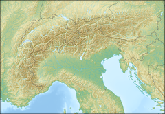
| Coordinates: 45°35′N 6°53′E / 45.59°N 6.88°E | |
| Country | France |
| Region | Auvergne-Rhône-Alpes |
| Department | Savoie |
| Arrondissement | Albertville |
| Canton | Bourg-Saint-Maurice |
| Intercommunality | Haute Tarentaise |
| Government | |
| • Mayor (2020–2026) | Yannick Amet[1] |
Area 1 | 100.15 km2 (38.67 sq mi) |
| Population (2022)[2] | 690 |
| • Density | 6.9/km2 (18/sq mi) |
| Time zone | UTC+01:00 (CET) |
| • Summer (DST) | UTC+02:00 (CEST) |
| INSEE/Postal code | 73232 /73640 |
| Elevation | 871–3,747 m (2,858–12,293 ft) |
| 1 French Land Register data, which excludes lakes, ponds, glaciers > 1 km2 (0.386 sq mi or 247 acres) and river estuaries. | |
| Sainte-Foy-Tarentaise | |
|---|---|
| Top elevation | 2,622 m (8,602 ft) |
| Base elevation | 1,550 m (5,090 ft) |
| Trails |
|
| Lift system |
|
| Website | www |
Sainte-Foy-Tarentaise (French pronunciation: [sɛ̃t fwa taʁɑ̃tɛz]) is a commune in the Savoie department in the Auvergne-Rhône-Alpes region in south-eastern France.
Sainte-Foy-Tarentaise is a village in the Tarentaise Valley in Savoie, France. The old village lies on the main road between Bourg-Saint-Maurice and Val-d'Isère. About 4 km above the village (turning left at La Thuile) is the ski resort of Sainte Foy (referred as Sainte Foy Station).
- ^ "Répertoire national des élus: les maires". data.gouv.fr, Plateforme ouverte des données publiques françaises (in French). 9 August 2021.
- ^ "Populations de référence 2022" (in French). The National Institute of Statistics and Economic Studies. 19 December 2024.
Previous Page Next Page


