Our website is made possible by displaying online advertisements to our visitors.
Please consider supporting us by disabling your ad blocker.
Sobienie-Jeziory
| Sobienie-Jeziory | |
| Munisipyo | |
| Nasod | |
|---|---|
| Gingsakopan | Województwo Mazowieckie |
| Powiat | Powiat otwocki |
| Gitas-on | 93 m (305 ft) |
| Tiganos | 51°56′08″N 21°19′53″E / 51.9356°N 21.3315°E |
| Area | 97.37 km2 (38 sq mi) |
| Population | 6,229 gikan sa enwiki |
| Density | 64 / km2 (166 / sq mi) |
| Timezone | CET (UTC+1) |
| - summer (DST) | CEST (UTC+2) |
| GeoNames | 7532258 |
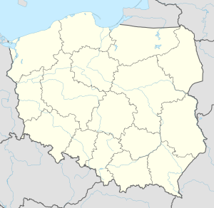
Munisipyo ang Sobienie-Jeziory sa Polskowa.[1] Nahimutang ni sa powiat sa Powiat otwocki ug gingsakopan sa Województwo Mazowieckie, sa sentro nga bahin sa nasod, 40 km sa habagatan-sidlakan sa Warsaw ang ulohan sa nasod. Adunay 6,229 ka molupyo.[2] Naglangkob kin og 97 ka kilometro kwadrado. Sobienie-Jeziory mopakigbahin sa usa ka utlanan sa Celestynów, Gmina Garwolin, Góra Kalwaria, Karczew, Osieck, Warka, ug Gmina Wilga.
Ang yuta sa Sobienie-Jeziory patag.[saysay 1]
Ang klima hemiboreal.[4] Ang kasarangang giiniton 7 °C. Ang kinainitan nga bulan Hulyo, sa 20 °C, ug ang kinabugnawan Disyembre, sa −8 °C.[5]
- ↑ Cite error: Invalid
<ref>tag; no text was provided for refs namedgn7532258 - ↑ Cite error: Invalid
<ref>tag; no text was provided for refs namedenwiki - ↑ Cite error: Invalid
<ref>tag; no text was provided for refs namedvp - ↑ Cite error: Invalid
<ref>tag; no text was provided for refs namedkoppen - ↑ Cite error: Invalid
<ref>tag; no text was provided for refs namednasa
Cite error: <ref> tags exist for a group named "saysay", but no corresponding <references group="saysay"/> tag was found
Previous Page Next Page


