Our website is made possible by displaying online advertisements to our visitors.
Please consider supporting us by disabling your ad blocker.
Uttara
| This article contains a translation of Uttara (neighbourhood) from en.wikipedia. |
Uttara
উত্তরা | |
|---|---|
Neighbourhoods in Dhaka Metropolitan Area | |
| Uttara Model Town | |
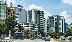
 Skyline of Uttara, Dhaka | |
| Coordinates: 23°52′37″N 90°22′37″E / 23.877°N 90.377°E | |
| Country | |
| Division | Dhaka Division |
| District | Dhaka District |
| Metropolitan | DNCC |
| Establishment | 1966 |
| Founded by | RAJUK |
| Area | |
| • Total | 36.91 km2 (14.25 sq mi) |
| Elevation | 23 m (75 ft) |
| Population (2011) | |
| • Total | 179,907 |
| • Density | 4,874.20/km2 (12,624.1/sq mi) |
| Time zone | UTC+6 (BST) |
| Postal code | 1230 |
Uttara Model Town or simply Uttara (Bengali: উত্তরা, romanised: Uttora) is a neighbourhood of Dhaka, the capital of Bangladesh. The name derives from the Bengali word uttor (উত্তর) meaning "north". It lies on the road to Gazipur, and adjoins Hazrat Shahjalal International Airport.
- ↑ "Geographic coordinates of Dhaka, Bangladesh". DATEANDTIME.INFO. Archived from the original on 10 August 2016. Retrieved 7 July 2016.
Previous Page Next Page


