Our website is made possible by displaying online advertisements to our visitors.
Please consider supporting us by disabling your ad blocker.
Boundiali
Boundiali | |
|---|---|
Town, sub-prefecture, and commune | |
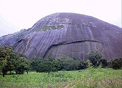
 A mountain near Boundiali | |
| Coordinates: 9°31′N 6°29′W / 9.517°N 6.483°W | |
| Country | |
| District | Savanes |
| Region | Bagoué |
| Department | Boundiali |
| Area | |
• Total | 1,480 km2 (570 sq mi) |
| Population (2021 census)[2] | |
• Total | 92,792 |
| • Density | 63/km2 (160/sq mi) |
| • Town | 39,962[1] |
| (2014 census) | |
| Time zone | UTC+0 (GMT) |
Boundiali is a town in northern Ivory Coast. It is a sub-prefecture of and the seat of Boundiali Department. It is also the seat of Bagoué Region in Savanes District and a commune.
Its population, the Boundialikas, is composed mainly of ethnic groups shared across the borders of Mali, Guinea, and Burkina Faso, as well as some Fulas. Boundiali is a centre for Senoufo people and is known for crafts. The inhabitants are chiefly farmers and stockbreeders as well as tradesmen or civil servants.
- ^ Citypopulation.de Population of cities & localities in Ivory Coast
- ^ Citypopulation.de Population of the regions and sub-prefectures of Ivory Coast
Previous Page Next Page


