Our website is made possible by displaying online advertisements to our visitors.
Please consider supporting us by disabling your ad blocker.
Carson Range
| Carson Range | |
|---|---|
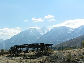
 Looking south from Genoa, Nevada, toward the Carson Range | |
| Highest point | |
| Peak | Freel Peak |
| Elevation | 10,881 ft (3,317 m)[1] |
| Dimensions | |
| Length | 50 mi (80 km) N-S |
| Width | 5–10 mi (8.0–16.1 km) E-W |
| Geography | |
| Country | United States |
| States |
|
| Range coordinates | 39°20′37.672″N 119°55′1.688″W / 39.34379778°N 119.91713556°W |
| Parent range | Sierra Nevada (U.S.) |
| Borders on | |
| Topo map | USGS Mount Rose |
The Carson Range is a spur of the Sierra Nevada in eastern California and western Nevada that starts at Carson Pass and stretches north to the Truckee River near Verdi, Nevada.
- ^ "Carson Range". Peakbagger.com. Retrieved 2012-11-16.
- ^ "Carson Range". Geographic Names Information System. United States Geological Survey, United States Department of the Interior. Retrieved 2009-05-03.
Previous Page Next Page


