Our website is made possible by displaying online advertisements to our visitors.
Please consider supporting us by disabling your ad blocker.
Portal:Indiana
The Indiana Portal
Indigenous resistance to American settlement was broken with defeat of the Tecumseh's confederacy in 1813. The new settlers were primarily Americans of British ancestry from the eastern seaboard and the Upland South, and Germans. After the Civil War, in which the state fought for the Union, natural gas attracted heavy industry and new European immigrants to its northern counties. In the first half of the 20th century, northern and central sections experienced a boom in goods manufacture and automobile production. Southern Indiana remained largely rural.
Today, Indiana has a diverse economy with a gross state product in 2023 of 404.3 billion. It has several metropolitan areas with populations greater than 100,000 and a number of smaller cities and towns. Indiana is home to professional sports teams, including the NFL's Indianapolis Colts, the NBA's Indiana Pacers, and the WNBA's Indiana Fever. The state also hosts several notable competitive events, such as the Indianapolis 500, held at Indianapolis Motor Speedway. (Full article...)
Selected article -
The Super Bowl XLVI halftime show took place on February 5, 2012, at the Lucas Oil Stadium in Indianapolis, Indiana as part of Super Bowl XLVI. It was headlined by Madonna, who became the first sole female headliner since Diana Ross in 1996. It featured guest appearances by LMFAO, Nicki Minaj, M.I.A. and CeeLo Green. Including collaborations with Cirque du Soleil, choreographer Jamie King as music director, and multimedia show producer Moment Factory, the show was critically acclaimed, setting a Super Bowl halftime show record at the time of 114 million viewers, higher than the viewership of the game itself.
Preparations began in January, with Madonna saying that the rehearsal was the most exhausting one in which she had ever participated. Costumes were designed by Riccardo Tisci, Givenchy, Miu Miu and Prada. The production team was allotted seven minutes to set up the stage, 12 minutes for the performance and eight minutes to take down the stage. The modular structure was assembled from a truck, with a large white fabric in front as media screens for Moment Factory. Projection mapping was used by video-hardware manufacturer Barco, with films modified for the spectators and the television audience. The stadium was equipped with Sharpys lighting arrangements from Clay Paky, and the show used Sennheiser sound equipment. (Full article...)
Selected image -
 |
Did you know -
- ... that Butt Drugs in Corydon, Indiana, had Butt Liquors and free parking in the rear?
- ... that Indianapolis's 2023 gun control ordinance – which bans assault weapons, among other measures – is a trigger law that only goes into effect if Indiana's state preemption law is repealed or struck down?
- ... that an Indiana university recently argued in court that The Silver Veil and the Golden Gate, a 1914 painting, was too modern for their art collection?
- ... that viewers of an Indiana TV station's newscast in 1995 could send emails to the presenter live on air?
- ... that frontier physician Isaac Coe is credited with saving Indianapolis from an 1821 outbreak of malaria?
- ... that the Circle Tower, an Art Deco building in Indianapolis, features ziggurat-like upper floors?
Related portals
Selected geographic article -
U.S. Route 30 (US 30) is a part of the United States Numbered Highway System that runs from Astoria, Oregon, to Atlantic City, New Jersey. In Indiana, the route runs from the Illinois state line at Dyer to the Ohio state line east of Fort Wayne and New Haven. The 156.217 miles (251.407 km) of US 30 that lie within Indiana serve as a major conduit. The entire length of US 30 in Indiana is included in the National Highway System (NHS). The highway includes four-lane rural sections, an urbanized four-lane divided expressway, and several high-traffic six-lane freeway areas. First designated as a U.S. Highway in 1926, US 30 replaced the original State Road 2 (SR 2) and SR 44 designation of the highway which dated back to the formation of the Indiana State Road system. A section of the highway originally served as part of the Lincoln Highway. Realignment and construction projects have expanded the highway to four lanes across the state, and the road is now part of a long stretch of US 30 from New Lenox, Illinois, to Canton, Ohio, where the road has at least four lanes (excluding ramps). There are over 40 traffic signals between Interstate 65 (I-65) at Merrillville and I-69 at Fort Wayne. (Full article...)
Selected biography -
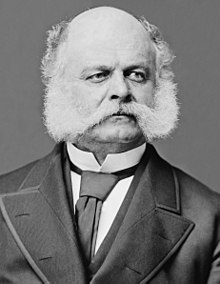
Ambrose Everts Burnside (May 23, 1824 – September 13, 1881) was an American army officer and politician who became a senior Union general in the Civil War and three-time Governor of Rhode Island, as well as being a successful inventor and industrialist.
He was responsible for some of the earliest victories in the Eastern theater, but was then promoted above his abilities, and is mainly remembered for two disastrous defeats, at Fredericksburg and the Battle of the Crater (Petersburg). Although an inquiry cleared him of blame in the latter case, he never regained credibility as an army commander. (Full article...)
Selected quote
General images
Topics
- Economy: AM General - ATA Airlines - Casinos - Cummins - Delta - ITT - JayC - Lilly - Limestone - Manufacturing - NiSource - Shoe Carnival - Simon Property Group - Soybeans - Studebaker - Vectren - WellPoint
- Geography: Caves - Lakes - Rivers - State forests - Watersheds
Categories
Attractions
 |
Recognized content
| This is a list of recognized content, updated weekly by JL-Bot (talk · contribs) (typically on Saturdays). There is no need to edit the list yourself. If an article is missing from the list, make sure it is tagged (e.g. {{WikiProject Indiana}}) or categorized correctly and wait for the next update. See WP:RECOG for configuration options. |
Good articles
- 1925 Tri-State tornado
- 1963 Indiana State Fairgrounds Coliseum gas explosion
- 2006 Brickyard 400
- 2011 South Bend mayoral election
- 2015 South Bend mayoral election
- 2019 South Bend mayoral election
- 2021 NCAA Division I men's basketball championship game
- Max Bielfeldt
- The Fault in Our Stars (film)
- Hurley Goodall
- R. Ames Montgomery
- Proposed South Shore Line station in South Bend
- Richmond, Indiana, facility fire
- WCAE
Featured pictures
-
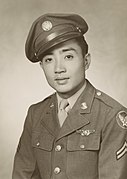
Kenje Ogata 1943
-
Kurt Vonnegut by Bernard Gotfryd (1965)
-
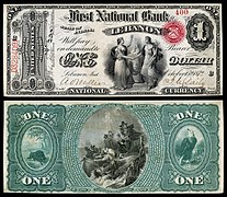
US-NBN-IL-Lebanon-2057-Orig-1-400-C
WikiProjects
State facts
Indiana | |
|---|---|
| Country | United States |
| Admitted to the Union | December 11, 1816 (19th) |
| Capital | Indianapolis |
| Largest city | Indianapolis |
| Largest metro and urban areas | Indianapolis-Carmel MSA |
| Government | |
| • Governor | Eric Holcomb (R) (2017) |
| • Lieutenant Governor | Suzanne Crouch (R) (2017) |
| Legislature | Indiana General Assembly |
| • Upper house | Senate |
| • Lower house | House of Representatives |
| U.S. senators | Todd Young (R) Mike Braun (R) |
| Population | |
• Total | 6,080,485 |
| • Density | 169.5/sq mi (65.46/km2) |
| Language | |
| • Official language | English |
| Latitude | 37° 46′ N to 41° 46′ N |
| Longitude | 84° 47′ W to 88° 6′ W |
Things you can do
 |
Here are some tasks awaiting attention:
|
Associated Wikimedia
The following Wikimedia Foundation sister projects provide more on this subject:
-
Commons
Free media repository -
Wikibooks
Free textbooks and manuals -
Wikidata
Free knowledge base -
Wikinews
Free-content news -
Wikiquote
Collection of quotations -
Wikisource
Free-content library -
Wikiversity
Free learning tools -
Wikivoyage
Free travel guide -
Wiktionary
Dictionary and thesaurus
- ^ a b "Elevations and Distances in the United States". U.S Geological Survey. 29 April 2005. Retrieved 2006-11-06.
{{cite web}}: CS1 maint: year (link)
Previous Page Next Page


