Our website is made possible by displaying online advertisements to our visitors.
Please consider supporting us by disabling your ad blocker.
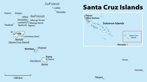
Utupua


Utupua is an island in the Santa Cruz Islands, located 66 km to the Southeast of the main Santa Cruz group, between Vanikoro and Santa Cruz proper (Nendö). This island belongs administratively to the Temotu Province of Solomon Islands.
Previous Page Next Page


