Our website is made possible by displaying online advertisements to our visitors.
Please consider supporting us by disabling your ad blocker.
Portal:Indiana
The Indiana Portal
Indigenous resistance to American settlement was broken with defeat of the Tecumseh's confederacy in 1813. The new settlers were primarily Americans of British ancestry from the eastern seaboard and the Upland South, and Germans. After the Civil War, in which the state fought for the Union, natural gas attracted heavy industry and new European immigrants to its northern counties. In the first half of the 20th century, northern and central sections experienced a boom in goods manufacture and automobile production. Southern Indiana remained largely rural.
Today, Indiana has a diverse economy with a gross state product in 2023 of 404.3 billion. It has several metropolitan areas with populations greater than 100,000 and a number of smaller cities and towns. Indiana is home to professional sports teams, including the NFL's Indianapolis Colts, the NBA's Indiana Pacers, and the WNBA's Indiana Fever. The state also hosts several notable competitive events, such as the Indianapolis 500, held at Indianapolis Motor Speedway. (Full article...)
Selected article -
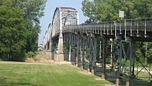
The New Harmony Toll Bridge, also known as the Harmony Way Bridge, is a now-closed two-lane bridge across the Wabash River that connects Illinois Route 14 with Indiana State Road 66, which is Church Street in New Harmony, Indiana. The bridge links White County, Illinois with Posey County, Indiana and carried U.S. Route 460 from 1947 until 1974 when the highway was decommissioned in Illinois and Indiana. The four-span bridge is owned by the White County Bridge Commission and was built without federal funds in 1930 by the Big Wabash Bridge Company of Carmi, Illinois. The next bridge across the Wabash about 15 miles (24 km) downstream is the Wabash Memorial Bridge near Mount Vernon, Indiana and the next bridge upstream is for Interstate 64, which does not allow farm vehicles. (Full article...)
Selected image -
 |
Did you know -
- ... that an Indiana newspaper donated its TV station to the local high school instead of shutting it down?
- ... that the Indianapolis African-American community raised $100,000 in just ten days in 1911 to establish the Senate Avenue YMCA?
- ... that Indianapolis's 2023 gun control ordinance – which bans assault weapons, among other measures – is a trigger law that only goes into effect if Indiana's state preemption law is repealed or struck down?
- ... that after the Wolverines released their "Moose" for his fifth season, he went on to win another Big Ten championship with the Hoosiers?
- ... that Ganggang, an Indianapolis-based cultural development firm for Black artists, created a fine art fair called "Butter" that also included a dance party called "Melt"?
- ... that an Indiana university recently argued in court that The Silver Veil and the Golden Gate, a 1914 painting, was too modern for their art collection?
Related portals
Selected geographic article -

Muncie (/ˈmʌnsi/ MUN-see) is an incorporated city and the seat of Delaware County, Indiana, United States. It is located in East Central Indiana about 50 miles (80 km) northeast of Indianapolis. At the 2020 census, the city's population was 65,195, down from 70,085 in the 2010 census. It is the principal city of the Muncie metropolitan statistical area, which encompasses all of Delaware County. The city is also included in the Indianapolis–Carmel–Muncie combined statistical area.
The Lenape people, led by Buckongahelas, arrived in the area in the 1790s. They founded several villages, including one known as Munsee Town, along the White River. The trading post, renamed Muncietown, was selected as the Delaware County seat and platted in 1827. Its name was officially shortened to Muncie in 1845 and incorporated as a city in 1865. Muncie developed as a manufacturing and industrial center, especially after the Indiana gas boom of the 1880s. It is home to Ball State University. As a result of the Middletown studies, sociological research that was first conducted in the 1920s, Muncie is said to be one of the most studied United States cities of its size. (Full article...)
Selected biography -
Tecumseh (/tɪˈkʌmsə, -si/ tih-KUM-sə, -see; c. 1768 – October 5, 1813) was a Shawnee chief and warrior who promoted resistance to the expansion of the United States onto Native American lands. A persuasive orator, Tecumseh traveled widely, forming a Native American confederacy and promoting intertribal unity. Even though his efforts to unite Native Americans ended with his death in the War of 1812, he became an iconic folk hero in American, Indigenous, and Canadian popular history.
Tecumseh was born in what is now Ohio at a time when the far-flung Shawnees were reuniting in their Ohio Country homeland. During his childhood, the Shawnees lost territory to the expanding American colonies in a series of border conflicts. Tecumseh's father was killed in battle against American colonists in 1774. Tecumseh was thereafter mentored by his older brother Cheeseekau, a noted war chief who died fighting Americans in 1792. As a young war leader, Tecumseh joined Shawnee Chief Blue Jacket's armed struggle against further American encroachment, which ended in defeat at the Battle of Fallen Timbers in 1794 and with the loss of most of Ohio in the 1795 Treaty of Greenville. (Full article...)
Selected quote
General images
Topics
- Economy: AM General - ATA Airlines - Casinos - Cummins - Delta - ITT - JayC - Lilly - Limestone - Manufacturing - NiSource - Shoe Carnival - Simon Property Group - Soybeans - Studebaker - Vectren - WellPoint
- Geography: Caves - Lakes - Rivers - State forests - Watersheds
Categories
Attractions
 |
Recognized content
| This is a list of recognized content, updated weekly by JL-Bot (talk · contribs) (typically on Saturdays). There is no need to edit the list yourself. If an article is missing from the list, make sure it is tagged (e.g. {{WikiProject Indiana}}) or categorized correctly and wait for the next update. See WP:RECOG for configuration options. |
Good articles
- 1925 Tri-State tornado
- 1963 Indiana State Fairgrounds Coliseum gas explosion
- 2006 Brickyard 400
- 2011 South Bend mayoral election
- 2015 South Bend mayoral election
- 2019 South Bend mayoral election
- 2021 NCAA Division I men's basketball championship game
- Max Bielfeldt
- The Fault in Our Stars (film)
- Hurley Goodall
- R. Ames Montgomery
- Proposed South Shore Line station in South Bend
- Richmond, Indiana, facility fire
- WCAE
Featured pictures
-
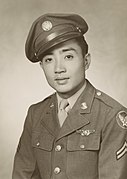
Kenje Ogata 1943
-
Kurt Vonnegut by Bernard Gotfryd (1965)
-
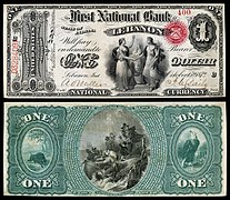
US-NBN-IL-Lebanon-2057-Orig-1-400-C
WikiProjects
State facts
Indiana | |
|---|---|
| Country | United States |
| Admitted to the Union | December 11, 1816 (19th) |
| Capital | Indianapolis |
| Largest city | Indianapolis |
| Largest metro and urban areas | Indianapolis-Carmel MSA |
| Government | |
| • Governor | Eric Holcomb (R) (2017) |
| • Lieutenant Governor | Suzanne Crouch (R) (2017) |
| Legislature | Indiana General Assembly |
| • Upper house | Senate |
| • Lower house | House of Representatives |
| U.S. senators | Todd Young (R) Mike Braun (R) |
| Population | |
• Total | 6,080,485 |
| • Density | 169.5/sq mi (65.46/km2) |
| Language | |
| • Official language | English |
| Latitude | 37° 46′ N to 41° 46′ N |
| Longitude | 84° 47′ W to 88° 6′ W |
Things you can do
 |
Here are some tasks awaiting attention:
|
Associated Wikimedia
The following Wikimedia Foundation sister projects provide more on this subject:
-
Commons
Free media repository -
Wikibooks
Free textbooks and manuals -
Wikidata
Free knowledge base -
Wikinews
Free-content news -
Wikiquote
Collection of quotations -
Wikisource
Free-content library -
Wikiversity
Free learning tools -
Wikivoyage
Free travel guide -
Wiktionary
Dictionary and thesaurus
- ^ a b "Elevations and Distances in the United States". U.S Geological Survey. 29 April 2005. Retrieved 2006-11-06.
{{cite web}}: CS1 maint: year (link)
Previous Page Next Page


