Our website is made possible by displaying online advertisements to our visitors.
Please consider supporting us by disabling your ad blocker.
Hommarting
 | |||
| |||
| Alministración | |||
| Departamentu | Meurthe (es) | ||
| Tipu d'entidá | comuña de Francia | ||
| Nome oficial | Hommarting (fr)[1] | ||
| Códigu postal |
57405 | ||
| Xeografía | |||
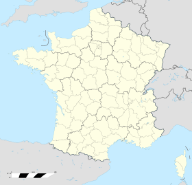
| Coordenaes | 48°44′19″N 7°08′43″E / 48.7386°N 7.1453°E | ||
 | |||
| Superficie | 10.19 km² | ||
| Altitú | 257 m[2] y 336 m[2] | ||
| Llenda con | Arzviller, Brouviller, Guntzviller, Niderviller y Réding | ||
| Demografía | |||
| Población |
831 hab. (1r xineru 2022) - 425 homes (2017) - 425 muyeres (2017) | ||
| Porcentaxe |
100% de Meurthe (es) | ||
| Densidá | 81,55 hab/km² | ||
| Más información | |||
| Estaya horaria |
UTC+01:00 (horariu estándar) UTC+02:00 (horariu de branu) | ||
| hommarting.fr | |||
Hommarting ye una comuña francesa del departamentu de Moselle, na rexón de Gran Este. Llenda con Arzviller, Brouviller, Guntzviller, Niderviller y Réding.
Tien una población de 831 hab. (1 xineru 2022)[3][4] y una superficie de 10,19[5] km².
- ↑ «code officiel géographique». Consultáu'l 6 xineru 2019.
- ↑ 2,0 2,1 Tienes d'especificar urlarchivu = y fechaarchivu = al usar {{cita web}}.«répertoire géographique des communes». Institut national de l'information géographique et forestière (2015).
- ↑ Afirmao en: Populations de référence 2022. Editorial: Institut national de la statistique et des études économiques. Llingua de la obra o nome: francés. Data d'espublización: 19 avientu 2024.
- ↑ censu de población
- ↑ Afirmao en: répertoire géographique des communes. Data de consulta: 26 ochobre 2015. Editorial: Institut national de l'information géographique et forestière.
Previous Page Next Page


