Our website is made possible by displaying online advertisements to our visitors.
Please consider supporting us by disabling your ad blocker.
I Rossati
| I Rossati | |
| Tagaytay | |
| Nasod | |
|---|---|
| Rehiyon | Trentino-Alto Adige |
| Lalawigan | Provincia di Trento |
| Range | Gruppo di Brenta |
| Gitas-on | 2,387 m (7,831 ft) |
| Tiganos | 46°07′31″N 10°54′53″E / 46.12524°N 10.91475°E |
| Highest point | |
| - elevation | 2,441 m (8,009 ft) |
| Width | 0.16 km (0 mi) |
| Height | 54 m (177 ft) |
| Timezone | CET (UTC+1) |
| - summer (DST) | CEST (UTC+2) |
| GeoNames | 6640220 |
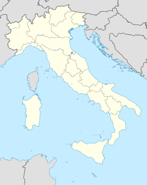
Tagaytay ang I Rossati sa Italya.[1] Nahimutang ni sa lalawigan sa Provincia di Trento ug rehiyon sa Trentino-Alto Adige, sa amihanang bahin sa nasod, 500 km sa amihanan sa Rome ang ulohan sa nasod. I Rossati mao ang bahin sa Gruppo di Brenta.[saysay 1]
Ang klima hemiboreal.[3] Ang kasarangang giiniton 9 °C. Ang kinainitan nga bulan Hunyo, sa 20 °C, ug ang kinabugnawan Enero, sa −2 °C.[4] Ang kasarangang pag-ulan 1,357 milimetro matag tuig. Ang kinabasaan nga bulan Nobiyembre, sa 170 milimetro nga ulan, ug ang kinaugahan Disyembre, sa 75 milimetro.[5]
- ↑ Cite error: Invalid
<ref>tag; no text was provided for refs namedgn6640220 - ↑ Cite error: Invalid
<ref>tag; no text was provided for refs namedvp - ↑ Cite error: Invalid
<ref>tag; no text was provided for refs namedkoppen - ↑ Cite error: Invalid
<ref>tag; no text was provided for refs namednasa - ↑ Cite error: Invalid
<ref>tag; no text was provided for refs namednasarain
Cite error: <ref> tags exist for a group named "saysay", but no corresponding <references group="saysay"/> tag was found
Previous Page Next Page


