Our website is made possible by displaying online advertisements to our visitors.
Please consider supporting us by disabling your ad blocker.
Schwaikheim (kapital sa munisipyo)
- Alang sa ubang mga dapit sa mao gihapon nga ngalan, tan-awa ang Schwaikheim.
| Schwaikheim | |
| Kapital sa munisipyo | |
| Nasod | |
|---|---|
| Estado pederal | Baden-Württemberg Region |
| Distrito nga gobyerno | Regierungsbezirk Stuttgart |
| Gitas-on | 267 m (876 ft) |
| Tiganos | 48°52′38″N 9°20′58″E / 48.87733°N 9.34958°E |
| Population | 9,295 (2011-04-25) [1] |
| Timezone | CET (UTC+1) |
| - summer (DST) | CEST (UTC+2) |
| GeoNames | 2835385 |
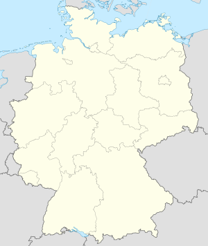
Kapital sa munisipyo ang Schwaikheim sa Alemanya.[1] Nahimutang ni sa distrito nga gobyerno sa Regierungsbezirk Stuttgart ug estado pederal sa Baden-Württemberg Region, sa habagatang bahin sa nasod, 500 km sa habagatan-kasadpan sa Berlin ang ulohan sa nasod. 267 metros ibabaw sa dagat kahaboga ang nahimutangan sa Schwaikheim[1], ug adunay 9,295 ka molupyo.[1]
Ang yuta palibot sa Schwaikheim kasagaran patag, apan sa habagatang-sidlakan nga kini mao ang kabungtoran.[saysay 1] Ang kinahabogang dapit sa palibot dunay gihabogon nga 465 ka metro ug 2.9 km sa habagatan sa Schwaikheim.[saysay 2] Dunay mga 493 ka tawo kada kilometro kwadrado sa palibot sa Schwaikheim nga hilabihan populasyon.[3]. Ang kinadul-ang mas dakong lungsod mao ang Stuttgart, 16.4 km sa habagatan-kasadpan sa Schwaikheim. Sa rehiyon palibot sa Schwaikheim, mga lasang, ug mga bungtod talagsaon komon.[saysay 3]
Hapit nalukop sa kaumahan ang palibot sa Schwaikheim.[4] Ang klima baybayon.[5] Ang kasarangang giiniton 10 °C. Ang kinainitan nga bulan Hulyo, sa 22 °C, ug ang kinabugnawan Disyembre, sa −4 °C.[6] Ang kasarangang pag-ulan 1,117 milimetro matag tuig. Ang kinabasaan nga bulan Hulyo, sa 143 milimetro nga ulan, ug ang kinaugahan Marso, sa 26 milimetro.[7]
| ||||||||||||||||||||||||||||||||||||||||||||||||||||||||||||||||||||||||||||||||||||||||||||||||||||||||||||||||||||||||||||
- ↑ 1.0 1.1 1.2 1.3 1.4 Cite error: Invalid
<ref>tag; no text was provided for refs namedgn2835385 - ↑ 2.0 2.1 Cite error: Invalid
<ref>tag; no text was provided for refs namedvp - ↑ Cite error: Invalid
<ref>tag; no text was provided for refs namednasapop - ↑ Cite error: Invalid
<ref>tag; no text was provided for refs namednasalandcover - ↑ Cite error: Invalid
<ref>tag; no text was provided for refs namedkoppen - ↑ 6.0 6.1 Cite error: Invalid
<ref>tag; no text was provided for refs namednasa - ↑ Cite error: Invalid
<ref>tag; no text was provided for refs namednasarain
Cite error: <ref> tags exist for a group named "saysay", but no corresponding <references group="saysay"/> tag was found
Previous Page Next Page


