Our website is made possible by displaying online advertisements to our visitors.
Please consider supporting us by disabling your ad blocker.
Caicos-Inseln
| Caicos-Inseln | ||
|---|---|---|
 | ||
| Gewässer | Atlantischer Ozean | |
| Geographische Lage | 21° 39′ N, 71° 54′ W | |
|
| ||
| Anzahl der Inseln | ca. 30 | |
| Hauptinsel | Providenciales | |
| Gesamte Landfläche | 460,2 km² | |
| Einwohner | 26.519 | |
 | ||
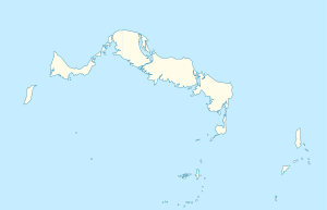
Die Caicos-Inseln (englisch Caicos Islands) sind eine Inselgruppe im Atlantischen Ozean etwa 200 Kilometer nördlich der Insel Hispaniola. Zusammen mit den knapp 40 Kilometer südöstlich liegenden Turks-Inseln bilden sie das Britische Überseegebiet der Turks- und Caicosinseln.
Zur Inselgruppe gehören über 30 Inseln, zu den bekannten gehören die Hauptinsel Providenciales sowie West Caicos, North Caicos, Middle Caicos, East Caicos und South Caicos.
Previous Page Next Page


