Our website is made possible by displaying online advertisements to our visitors.
Please consider supporting us by disabling your ad blocker.
Firth of Forth
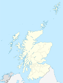
Koordinaten: 56° 0′ 36″ N, 3° 10′ 12″ W


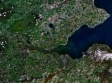
Der Firth of Forth (schottisch-gälisch Linne Foirthe) ist ein Meeresarm an der Ostküste von Schottland und gleichzeitig die Mündung des Flusses Forth in die Nordsee. Das englische Wort Firth bedeutet „Förde“ oder „Fjord“. Präformiert wurde die Rinne des Firth of Forth in der letzten britischen Eiszeitphase durch den vom Hochland herabwandernden Forth-Gletscher.[1] Darum ist der Firth of Forth geologisch ein Fjord. Er ist vom Ort Kinkardine bis zur Isle of May gerechnet etwa 80 km lang und bis zu 21 km breit.
- ↑ David J.A. Evansa et al.: The last British Ice Sheet: A review of the evidence utilised in the compilation of the Glacial Map of Britain in Earth-Science Reviews Volume 70, Issues 3-4, May 2005, Pages 253–312
Previous Page Next Page


