Our website is made possible by displaying online advertisements to our visitors.
Please consider supporting us by disabling your ad blocker.
Hispaniola
| Hispaniola
| |
|---|---|
 | |
| Gewässer | Karibisches Meer |
| Inselgruppe | Große Antillen |
| Geographische Lage | 19° 0′ N, 70° 40′ W |
| Fläche | 76.480 km² |
| Höchste Erhebung | Pico Duarte 3098 m |
| Einwohner | 21.748.227 (2017) 284 Einw./km² |
| Hauptort | Santo Domingo / Port-au-Prince |
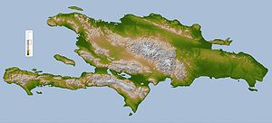
Hispaniola (auch Hispañola; spanisch La Española ‚die Spanische‘) oder Kiskeya (in der Sprache der Taíno), spanisch Quisqueya, ist mit einer Fläche von etwa 76.480 km² die zweitgrößte der Großen Antillen und gleichzeitig der gesamten Westindischen Inseln. Auf der Insel liegen die Staaten Haiti und Dominikanische Republik.
Previous Page Next Page


