Our website is made possible by displaying online advertisements to our visitors.
Please consider supporting us by disabling your ad blocker.
Indianapolis
| Indianapolis | ||
|---|---|---|
| Spitzname: Indy, the Circle City, the Crossroads of America, the Racing Capital of the World | ||
 Von links oben nach unten: das Soldiers’ and Sailors’ Monument und der Indiana World War Memorial Plaza. Von rechts oben nach unten: das Indiana Statehouse, das Lucas Oil Stadium und der Indianapolis Motor Speedway. Von links oben nach unten: das Soldiers’ and Sailors’ Monument und der Indiana World War Memorial Plaza. Von rechts oben nach unten: das Indiana Statehouse, das Lucas Oil Stadium und der Indianapolis Motor Speedway. | ||
 | ||
| Indianapolis | ||
|
| ||
| Basisdaten | ||
| Gründung: | 1821 | |
| Staat: | Vereinigte Staaten | |
| Bundesstaat: | Indiana | |
| County: | Marion County | |
| Koordinaten: | 39° 46′ N, 86° 9′ W | |
| Zeitzone: | Eastern (UTC−5/−4) | |
| Einwohner: – Metropolregion: |
887.642 (Stand: 2020) 2.111.040 (Stand: 2020) | |
| Haushalte: | 342.825 (Stand: 2020) | |
| Fläche: | 963,5 km² (ca. 372 mi²) davon 945,6 km² (ca. 365 mi²) Land | |
| Bevölkerungsdichte: | 939 Einwohner je km² | |
| Höhe: | 219 m | |
| Postleitzahlen: | 46201–46209, 46211, 46214
46216–46231, 46234–46237 46239–46242, 46244, 46247 46249–46251, 46253–46256 46259, 46260, 46266, 46268 46274, 46275, 46277, 46278 46280, 46282, 46283, 46285 46290, 46291, 46295, 46296 46298 | |
| Vorwahl: | +1 317 | |
| FIPS: | 18-36003 | |
| GNIS-ID: | 452890 | |
| Website: | www.indy.gov | |
| Bürgermeister: | Joe Hogsett[1] | |
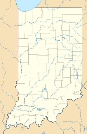
Indianapolis [] ist die Hauptstadt des US-Bundesstaates Indiana in den Vereinigten Staaten von Amerika. Bei der Volkszählung 2020 wurden 887.642[2] Einwohner in Indianapolis gezählt, was es zur drittgrößten Stadt im mittleren Westen der USA macht.[3] Die Indianapolis Metropolitan Area (Indianapolis plus Vororte) zählt rund 2.100.000 Einwohner (Stand: 2020). Die City ist der Verwaltungssitz des Marion County.
Der Indianapolis International Airport ist ein internationaler Flughafen.
- ↑ www.indy.gov. (abgerufen am 31. August 2022).
- ↑ Explore Census Data Indianapolis city (balance), Indiana. Abgerufen am 18. Oktober 2022.
- ↑ U.S. Census Bureau QuickFacts: Indianapolis city (balance), Indiana. Abgerufen am 21. August 2021 (englisch).
Previous Page Next Page


