Our website is made possible by displaying online advertisements to our visitors.
Please consider supporting us by disabling your ad blocker.
A730 road
This article needs additional citations for verification. (September 2021) |
| A730 | ||||
|---|---|---|---|---|
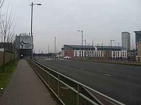
 A730 New Rutherglen Road, Oatlands | ||||
| Route information | ||||
| Length | 5.1 mi[1] (8.2 km) | |||
| Major junctions | ||||
| Northwest end | Glasgow (Gorbals) | |||
| Southeast end | Rutherglen (Cathkin) | |||
| Location | ||||
| Country | United Kingdom | |||
| Constituent country | Scotland | |||
| Road network | ||||
| ||||
The A730 road in Scotland runs between the centre of Glasgow and the south-eastern edge of the city's urban area at Cathkin.
Previous Page Next Page


