Our website is made possible by displaying online advertisements to our visitors.
Please consider supporting us by disabling your ad blocker.
Abu Musa
| Other names |
|
|---|---|
| Geography | |
| Location | Persian Gulf |
| Coordinates | 25°52′N 55°02′E / 25.867°N 55.033°E |
| Total islands | 1 |
| Area | 12.8 km2 (4.9 sq mi) |
| Highest elevation | 110 m (360 ft) |
| Highest point | Mount Halva |
| Administration | |
| Province | Hormozgan |
| Largest settlement | Abu Musa (pop. 1,953) |
| Demographics | |
| Population | 2,131 (2012) |
| Pop. density | 166/km2 (430/sq mi) |
 | |
| Location | Abu Musa, Iran |
|---|---|
| Coordinates | 25°53′07″N 55°02′02″E / 25.88514°N 55.03394°E |
| Tower | |
| Construction | Masonry Tower |
| Shape | square short tower atop building[1][2] |
| Light | |
| Focal height | 130 m (430 ft) |
| Range | 9 nmi (17 km; 10 mi) |
| Characteristic | Fl W 8s |

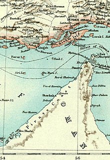
Abu Musa (Bu Musa) (Persian: بوموسا ⓘ, IPA: [æbu mu'sɒ] ) is an Iranian 12.8-square-kilometre (4.9 sq mi) island in the eastern Persian Gulf, found near the entrance of Strait of Hormuz.[3] Due to the depth of sea, oil tankers and big ships have to pass between Abu Musa and Greater and Lesser Tunbs, making these islands some of the most strategic points in the Persian Gulf.[4] The island is under the administration of Iran, as part of the Hormozgan province.[5][6]
- ^ Rowlett, Russ. "Lighthouses of Iran". The Lighthouse Directory. University of North Carolina at Chapel Hill. Retrieved 3 October 2016.
- ^ NGA List of Lights – Pub.112 Archived 21 October 2016 at the Wayback Machine Retrieved 3 October 2016
- ^ Iranian Islands of Tunbs and Abu Musa Archived 23 September 2006 at the Wayback Machine
- ^ Ewan W. Anderson; Gareth Owen (1993). An atlas of world political flashpoints: a sourcebook of geopolitical crisis. Pinter Reference. p. 1. ISBN 978-1-85567-053-2. Archived from the original on 30 May 2016. Retrieved 19 February 2016.
- ^ Fred M. Shelley (30 April 2013). Nation Shapes: The Story Behind the World's Borders. ABC-CLIO. pp. 457–. ISBN 978-1-61069-106-2. Archived from the original on 30 May 2016. Retrieved 19 February 2016.
- ^ Ibrahim Abed; Peter Hellyer (2001). United Arab Emirates: A New Perspective. Trident Press Ltd. pp. 182–. ISBN 978-1-900724-47-0. Archived from the original on 30 May 2016.
Iran claims Abu Musa Territorial and political ambitions, combined with the economic interests of influential elements within the government, helped strengthen the first Iranian claim to the island of Abu Musa in 1904. Iran began to challenge ...
Previous Page Next Page


