Our website is made possible by displaying online advertisements to our visitors.
Please consider supporting us by disabling your ad blocker.
Abu Zurayq
Abu Zurayq
Abu Zureiq or Abu Zreiq | |
|---|---|
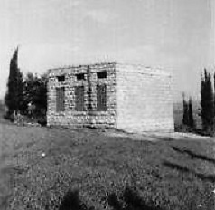
 A school in Abu Zurayq, pre-1948 | |
 | |
| Palestine grid | 162/226 |
| Geopolitical entity | Mandatory Palestine |
| Subdistrict | Haifa |
| Date of depopulation | April 12–13, 1948[1] |
| Area | |
• Total | 6,493 dunams (6.493 km2 or 2.507 sq mi) |
| Population (1945) | |
• Total | 550[2][3] |
| Cause(s) of depopulation | 1948 Palestinian expulsion |
Abu Zurayq is a cluster of archaeological sites at a well-watered spot at the western edge of the Jezreel Valley and its transition to the Menashe Heights, next to Highway 66, between the modern kibbutzim of HaZore'a and Mishmar HaEmek.
The site includes a tell (archaeological mound) called in Hebrew Tel Zariq (תל זריק) and Tell Abu Zureiq in Arabic, a spring called Ein Zariq, and other sites around it. The site was surveyed by Avner Raban as part of the survey of the Mishmar HaEmek area between 1974 and 1976. Based on the pottery collected by his team, the site was inhabited continuously from the Neolithic to the Ottoman periods.[4] The site is named after a Muslim saint who is buried there.[5]
In the 20th century, it was a Palestinian Turkmen village in the Haifa Subdistrict of Mandatory Palestine, situated near Wadi Abu Zurayq. The area was also named Et Tawatiha,[6][7] after the al-Tawatiha tribe, one of the three "true" Turkmen tribes in Palestine.[8]
It was depopulated on April 12–13 during and after the Battle of Mishmar HaEmek of the 1947–48 Civil War in Mandatory Palestine.
- ^ Morris, 2004, p. xviii, village #153. Also gives causes of depopulation.
- ^ Government of Palestine, Department of Statistics, 1945, p. 13
- ^ Government of Palestine, Department of Statistics. Village Statistics, April, 1945. Quoted in Hadawi, 1970, p. 47 Archived 2016-03-03 at the Wayback Machine
- ^ Ayala Sussmann, Avner Raban, 2013, Tel Zariq
- ^ Cite error: The named reference
Benvenisti74was invoked but never defined (see the help page). - ^ The Survey of Palestine, map at File:16-22-Megiddo-1932.jpg (upper left), shows the village named as Abu Zureiq but the village lands as "Abu Zureiq (Et Tawatiha)"
- ^ Kushner, David: "The Turcomans in Palestine during the Ottoman Period." International Journal of Turkish Studies vol 11, nos. 1–2 (Fall 2005), 81–94
- ^ YUSUF, Muhsin; ANABISA, Ghaleb. Les Turkmènes en Palestine: histoire et devenir In: Temps et espaces en Palestine: Flux et résistances identitaires, Beyrouth, Liban: Presses de l’Ifpo, 2008 ISBN 9782351592656. doi:10.4000/books.ifpo.480 "Un certain nombre de témoignages, dont celui de Fakhrî al-Turkmân, soulignent qu’il existe seulement trois « véritables » tribus turkmènes : al-Shqîrât, al-Tawatiha et al-Naghnaghiya. Si ces récits s’avèrent crédibles, alors la grande majorité des Turkmènes de Palestine sont des Arabes descendant des Turkmènes."
Previous Page Next Page


