Our website is made possible by displaying online advertisements to our visitors.
Please consider supporting us by disabling your ad blocker.
Agger (river)
| Agger | |
|---|---|
 | |
 | |
| Location | |
| Country | Germany |
| State | North Rhine-Westphalia |
| Physical characteristics | |
| Source | |
| • location | Sauerland |
| Mouth | |
• location | Sieg |
• coordinates | 50°48′2″N 7°10′27″E / 50.80056°N 7.17417°E |
| Length | 69.5 km (43.2 mi)[1] |
| Basin size | 816 km2 (315 sq mi)[1] |
| Basin features | |
| Progression | Sieg→ Rhine→ North Sea |
| Tributaries | |
| • left | Wiehl, Naafbach |
| • right | Leppe, Sülz |
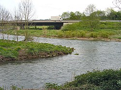
The Agger is a river in Germany, a right tributary of the Sieg in North Rhine-Westphalia. It is 69.5 kilometres (43.2 mi) long. Its source is in the Sauerland hills, near Meinerzhagen. It winds through the towns Engelskirchen, Overath and Lohmar. Near Siegburg the Agger flows into the Sieg.
Previous Page Next Page


