Our website is made possible by displaying online advertisements to our visitors.
Please consider supporting us by disabling your ad blocker.
Al-Walaja
Al-Walaja | |
|---|---|
| Arabic transcription(s) | |
| • Arabic | الولجة |
| • Latin | Al-Walaja (official) |
 | |
Location of al-Walaja within Palestine | |
| Coordinates: 31°44′8″N 35°9′39″E / 31.73556°N 35.16083°E | |
| State | |
| Governorate | Bethlehem |
| Founded | 1949 |
| Government | |
| • Type | Village council |
| • Head of Municipality | Saleh Hilmi Khalifa |
| Area | |
• Total | 17,708[1] dunams (17.7 km2 or 6.8 sq mi) |
| Population (2017)[2] | |
• Total | 2,671 |
| Name meaning | "The bosom of the hill"[3] |
al-Walaja
الولجة al-Walaje, el-Welejeh | |
|---|---|
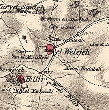
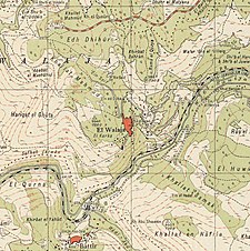
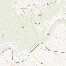
A series of historical maps of the area around Al-Walaja (click the buttons) | |
Location within Mandatory Palestine | |
| Coordinates: 31°44′27″N 35°8′46″E / 31.74083°N 35.14611°E | |
| Palestine grid | 163/127 |
| Geopolitical entity | Mandatory Palestine |
| Subdistrict | Jerusalem |
| Date of depopulation | October 21, 1948[5] |
| Area | |
• Total | 17,708 dunams (17.7 km2 or 6.8 sq mi) |
| Population (1945) | |
• Total | 1,650[1][4] |
| Cause(s) of depopulation | Military assault by Yishuv forces |
| Current Localities | Amminadav[6] |

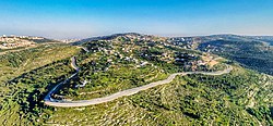
Al-Walaja (Arabic: الولجة) is a Palestinian village in the West Bank, in the Bethlehem Governorate of the State of Palestine, four kilometers northwest of Bethlehem. It is an enclave in the Seam Zone, near the Green Line. Al-Walaja is partly under the jurisdiction of the Bethlehem Governorate and partly of the Jerusalem Municipality. According to the Palestinian Central Bureau of Statistics, the village had a population of 2,671 in 2017.[2] It has been called 'the most beautiful village in Palestine'.[7]
Al-Walaja was depopulated during the 1948 Arab-Israeli War, in October 1948.[5] It lost about 70% of its land, west of the Green Line. After the war, the displaced inhabitants resettled on the remaining land in the West Bank. After its occupation by Israel during the Six-Day War, Israel annexed about half of al-Walaja's remaining land, including the neighborhood Ain Jawaizeh, to the Jerusalem Municipality. Large parts of the land were confiscated for the construction of the Israeli West Bank barrier and the Israeli settlements of Har Gilo and Gilo, one of the Ring Settlements of East Jerusalem.
- ^ a b Cite error: The named reference
Hadawi58was invoked but never defined (see the help page). - ^ a b Preliminary Results of the Population, Housing and Establishments Census, 2017 (PDF). Palestinian Central Bureau of Statistics (PCBS) (Report). State of Palestine. February 2018. pp. 64–82. Retrieved 2023-10-24.
- ^ Palmer, 1881, p. 338
- ^ Department of Statistics, 1945, p. 25
- ^ a b Cite error: The named reference
Morris_2004was invoked but never defined (see the help page). - ^ Khalidi, 1992, p. 323
- ^ David Dean Shulman, "On Being Unfree: Fences, Roadblocks and the Iron Cage of Palestine", Manoa Vol. 20, No. 2, 2008, pp. 13-32
Previous Page Next Page


