Our website is made possible by displaying online advertisements to our visitors.
Please consider supporting us by disabling your ad blocker.
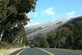
Alpine Way
Alpine Way | |
|---|---|
 | |
| Alpine Way, near Thredbo | |
| Coordinates | |
| General information | |
| Type | Rural road |
| Length | 121.3 km (75 mi)[1] |
| Gazetted | January 1993[2] |
| Major junctions | |
| East end | Kosciuszko Road Jindabyne, New South Wales |
| |
| West end | NSW/VIC border |
| Location(s) | |
| Major settlements | Thredbo, Khancoban |
| Restrictions | |
| General | Carrying snow chains may be required at certain times of the year. |
| Highway system | |
| ---- | |
Alpine Way is a 121-kilometre (75 mi) rural road located in the Snowy Mountains region of New South Wales, Australia. The road connects Jindabyne in the east to the New South Wales-Victorian border in the west, crossing the Murray River near Bringenbrong and Upper Towong.
- ^ "Alpine Way" (Map). Google Maps. Retrieved 18 July 2023.
- ^ "State Roads Act". Government Gazette of the State of New South Wales. No. 5. National Library of Australia. 15 January 1993. p. 125. Archived from the original on 18 July 2023. Retrieved 18 July 2023.
Previous Page Next Page


