Our website is made possible by displaying online advertisements to our visitors.
Please consider supporting us by disabling your ad blocker.
Alppiharju
Alppiharju
Åshöjden | |
|---|---|
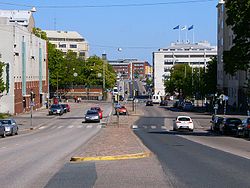
 Sturenkatu street towards the east in Alppiharju. | |
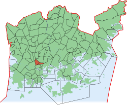
 Position of Alppiharju within Helsinki | |
| Country | |
| Region | Uusimaa |
| Sub-region | Greater Helsinki |
| Municipality | Helsinki |
| District | Central |
Area | 0.87 km2 (0.34 sq mi) |
| Population | 11,481 |
| • Density | 13,197/km2 (34,180/sq mi) |
| Postal codes | 00510, 00520 |
| Subdivision number | 12 |
| Neighbouring subdivisions | Sörnäinen, Kallio, Taka-Töölö, Pasila, Vallila |
Alppiharju (Swedish: Åshöjden) is a district of approximately 12,000 inhabitants in the eastern part of the Central major district of Helsinki, Finland. It consists of sub-districts Alppila and Harju, and is bordered by Kallio in the south, Taka-Töölö in the west, Pasila in the north-west and north, and Vallila in the north-east and east.[1]
- ^ "Helsinki by district 2014" (PDF) (in Finnish, Swedish, and English). City of Helsinki Urban Facts. Retrieved 19 April 2016.
Previous Page Next Page


