Our website is made possible by displaying online advertisements to our visitors.
Please consider supporting us by disabling your ad blocker.
Ammuqa
Ammuqa
عموقه Amuka, 'Amuqa | |
|---|---|
Village | |
| Etymology: "deep"[1] | |
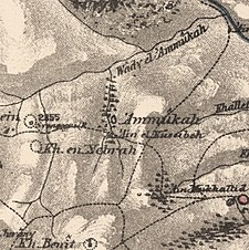
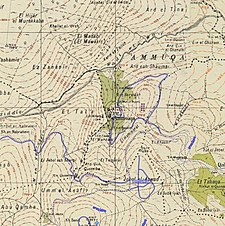
A series of historical maps of the area around Ammuqa (click the buttons) | |
Location within Mandatory Palestine | |
| Coordinates: 33°00′22″N 35°31′13″E / 33.00611°N 35.52028°E | |
| Palestine grid | 198/267 |
| Geopolitical entity | Mandatory Palestine |
| Subdistrict | Safad |
| Date of depopulation | 24 May 1948[4] |
| Area | |
• Total | 2,574 dunams (2.574 km2 or 636 acres) |
| Population (1945) | |
• Total | 140[2][3] |
| Cause(s) of depopulation | Military assault by Yishuv forces |
| Current Localities | Amuka[5] |
Ammuqa (also transliterated 'Amuqa and Amuka) was a Palestinian village, located five kilometres northeast of Safed.
In the late 19th century, Ammuqa was one of several villages resettled by Algerian migrants under the auspices of the Ottoman Empire.
Ammuqa was depopulated by Israeli forces in May 1948.
- ^ Palmer, 1881, p. 66
- ^ a b Government of Palestine, Department of Statistics. Village Statistics, April, 1945, quoted in Hadawi, 1970, p. 69 Archived 2011-06-04 at the Wayback Machine.
- ^ Department of Statistics, 1945, p. 9
- ^ Morris, 2004, p. xvi, village # 47. Also gives the cause of depopulation.
- ^ Khalidi, 1992, p. 434
Previous Page Next Page


