Our website is made possible by displaying online advertisements to our visitors.
Please consider supporting us by disabling your ad blocker.
Bad Pyrmont
This article needs additional citations for verification. (June 2015) |
Bad Pyrmont | |
|---|---|
 Bad Pyrmont Holy Bath | |
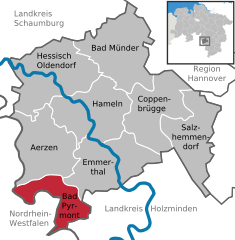
Location of Bad Pyrmont within Hameln-Pyrmont district  | |
| Coordinates: 51°59′12″N 09°15′49″E / 51.98667°N 9.26361°E | |
| Country | Germany |
| State | Lower Saxony |
| District | Hameln-Pyrmont |
| Subdivisions | 9 subdivisions |
| Government | |
| • Mayor (2021–26) | Klaus Blome[1] (CDU) |
| Area | |
• Total | 61.96 km2 (23.92 sq mi) |
| Population (2022-12-31)[2] | |
• Total | 19,604 |
| • Density | 320/km2 (820/sq mi) |
| Time zone | UTC+01:00 (CET) |
| • Summer (DST) | UTC+02:00 (CEST) |
| Postal codes | 31812 |
| Dialling codes | 05281 |
| Vehicle registration | HM |
| Website | www |
County (Principality) of Pyrmont Grafschaft (Fürstentum) Pyrmont (German) | |||||||||||
|---|---|---|---|---|---|---|---|---|---|---|---|
| 1194–1918 | |||||||||||
| Status | State of the Holy Roman Empire, State of the Confederation of the Rhine, State of the German Confederation, State of the North German Confederation, State of the German Empire | ||||||||||
| Capital | Lügde | ||||||||||
| Government | Principality | ||||||||||
| Historical era | Middle Ages | ||||||||||
• Partitioned from Schwalenberg | 1194 | ||||||||||
• Comital line extinct; to Spiegelberg | 1494 | ||||||||||
• To Lippe | 1557 | ||||||||||
• To Gleichen | 1583 | ||||||||||
• To Waldeck | 1625 | ||||||||||
| 1668 | |||||||||||
• Regained independence | 1805–12 | ||||||||||
• Prussian administration | from 1868 | ||||||||||
| 1918 | |||||||||||
• Joined Prussian province of Hanover | 1921 | ||||||||||
| |||||||||||
Bad Pyrmont (German: [baːt pʏʁˈmɔnt] ⓘ, also: [- ˈpʏʁ-]; West Low German: Bad Purmunt) is a town in the district of Hamelin-Pyrmont, in Lower Saxony, Germany, with a population close to 19,000. It is located on the river Emmer, about 10 km (6.2 mi) west of the Weser. Bad Pyrmont is a popular spa resort that gained its reputation as a fashionable place for princely vacations in the 17th and 18th centuries. The town is also the center of the Religious Society of Friends (Quakers) in Germany.
- ^ "Stichwahlen zu Direktwahlen in Niedersachsen vom 26. September 2021" (PDF). Landesamt für Statistik Niedersachsen. 13 October 2021.
- ^ "LSN-Online Regionaldatenbank, Tabelle A100001G: Fortschreibung des Bevölkerungsstandes, Stand 31. Dezember 2022" (in German). Landesamt für Statistik Niedersachsen.
Previous Page Next Page


