Our website is made possible by displaying online advertisements to our visitors.
Please consider supporting us by disabling your ad blocker.
Baudisson Island
Nickname: Nickname : Baudissin Island, Binnigem, Baudissen Island, Binnigen Island | |
|---|---|
| Geography | |
| Location | Oceania |
| Coordinates | 2°43′42″S 150°40′08″E / 2.72833°S 150.66889°E |
| Adjacent to | Bismarck Sea |
| Total islands | 5 |
| Area | 23.4 km2 (9.0 sq mi) |
| Administration | |
| Province | |
| District | Kavieng District |
| LLG | Tikana Rural LLG |
| Island Group | New Ireland |
| Demographics | |
| Ethnic groups | Papauans, Austronesians, Melanesians. |
| Additional information | |
| Time zone | |
| ISO code | PG-MBA |
| Official website | www |
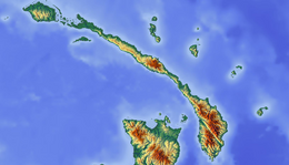
Baudisson Island is an island of Papua New Guinea, located south of New Hanover Island and west of the northern part of New Ireland. It is located between Selapiu Island and Manne Island. There is a plantation on the island.[1]
- ^ Peterson, Boyd D.; Garren, William R.; Heyda, Charles M. (1982). Gazetteer of Papua New Guinea: names approved by the United States Board on Geographic Names. United States. Defense Mapping Agency, United States Board on Geographic Names. p. 51. Retrieved 31 December 2012.
Previous Page Next Page


