Our website is made possible by displaying online advertisements to our visitors.
Please consider supporting us by disabling your ad blocker.
Brasted
| Brasted | |
|---|---|
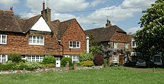
 The village green at Brasted | |
Location within Kent | |
| Population | 1,429 (2011 census)[1] |
| Civil parish |
|
| District | |
| Shire county | |
| Region | |
| Country | England |
| Sovereign state | United Kingdom |
| Post town | WESTERHAM |
| Postcode district | TN16 |
| Dialling code | 01959 |
| Police | Kent |
| Fire | Kent |
| Ambulance | South East Coast |
| UK Parliament | |
Brasted /ˈbreɪstɛd/[2] is a village and civil parish in the Sevenoaks District of Kent, England. Brasted lies on the A25 road, between Sundridge and Westerham; the road is named Westerham Road, High Street and Main Road as it passes through the village east to west. Brasted is 6 km west of Sevenoaks town. The parish had a population of 1321 (2001 census) and includes the hamlets of Brasted Chart, Toys Hill and Puddledock. The village of Brasted has a number of 18th-century houses with several antique shops, pubs and residences. The parish church is dedicated to St Martin.
- ^ "Civil Parish population 2011". Neighbourhood Statistics. Office for National Statistics. Archived from the original on 20 October 2016. Retrieved 18 September 2016.
- ^ G.M. Miller, BBC Pronouncing Dictionary of British Names (Oxford UP, 1971), p. 20.
Previous Page Next Page


