Our website is made possible by displaying online advertisements to our visitors.
Please consider supporting us by disabling your ad blocker.
Broughton Strait
| Broughton Strait | |
|---|---|
 View of Broughton Strait from Port McNeil | |
| Location | British Columbia, Canada |
| Coordinates | 50°36′13″N 127°02′08″W / 50.6036°N 127.0356°W |
| Type | strait |
| Part of | Queen Charlotte Strait |
| Islands | Haddington Island |
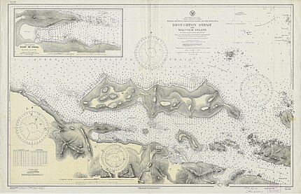
Broughton Strait is a strait off the north coast of Vancouver Island, British Columbia, Canada,[1][2] separating that island from Malcolm and Cormorant Islands, on the farther side of which is the larger Queen Charlotte Strait, which also lies beyond the western end of Broughton Strait, and the mouth of Knight Inlet. Farther east from Broughton Strait is the beginning of Johnstone Strait, which leads via Discovery Passage to the Strait of Georgia.
Communities on the Broughton Strait include Port McNeill, on Vancouver Island, and Sointula and Alert Bay, on Malcolm and Cormorant Islands respectively. Haddington Island is located in the middle of the strait.[3]
- ^ "Broughton Strait". Geographical Names Data Base. Natural Resources Canada. Retrieved 31 January 2024.
- ^ "Broughton Strait". BC Geographical Names. Retrieved 31 January 2024.
- ^ "Haddington Island". BC Geographical Names. Retrieved 31 January 2024.
Previous Page Next Page


