Our website is made possible by displaying online advertisements to our visitors.
Please consider supporting us by disabling your ad blocker.
Brownsville, Kentucky
Brownsville, Kentucky | |
|---|---|
 Aerial photograph of Brownsville | |
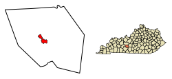
 Location of Brownsville in Edmonson County, Kentucky. | |
| Coordinates: 37°11′28″N 86°15′40″W / 37.19111°N 86.26111°W | |
| Country | United States |
| State | Kentucky |
| County | Edmonson |
| Established | 1826[1] |
| Government | |
| Area | |
• Total | 2.62 sq mi (6.78 km2) |
| • Land | 2.61 sq mi (6.77 km2) |
| • Water | 0.01 sq mi (0.02 km2) |
| Elevation | 541 ft (165 m) |
| Population (2020) | |
• Total | 875 |
| • Density | 334.99/sq mi (129.33/km2) |
| Time zone | UTC-6 (Central (CST)) |
| • Summer (DST) | UTC-5 (CDT) |
| ZIP code | 42210 |
| Area code(s) | 270 & 364 |
| FIPS code | 21-10324 |
| GNIS feature ID | 0488045[3] |
Brownsville is a home rule-class city in Edmonson County, Kentucky, in the United States. It is the county seat and is a certified Kentucky Trail Town.[4] The population was 836 at the time of the 2010 census,[5] down from 921 at the 2000 census. It is included in the Bowling Green metropolitan area.[6] It is just outside Mammoth Cave National Park.[7]
- ^ Cite error: The named reference
estdatewas invoked but never defined (see the help page). - ^ "2020 U.S. Gazetteer Files". United States Census Bureau. Retrieved March 18, 2022.
- ^ a b U.S. Geological Survey Geographic Names Information System: Brownsville, Kentucky
- ^ "Find a County". National Association of Counties. Archived from the original on May 31, 2011. Retrieved June 7, 2011.
- ^ "Geographic Identifiers: 2010 Demographic Profile Data (G001): Brownsville city, Kentucky". American Factfinder. U.S. Census Bureau. Archived from the original on February 13, 2020. Retrieved January 29, 2016.
- ^ Management and Budget, Office of (November 20, 2008). "OMB BULLETIN NO. 09-01" (PDF). the President, Executive Office of. Retrieved April 15, 2010.
- ^ Service, National Park. "Mammoth Cave National Park Map" (PDF). Retrieved April 15, 2010.
Previous Page Next Page
براونزفيل (كنتاكي) Arabic براونزفيل (ادمونسون) ARZ براونزویل، کنتاکی AZB Brownsville (Kentucky) Catalan Браунсвилл (Кентукки) CE Brownsville (kapital sa kondado sa Tinipong Bansa, Kentucky) CEB Brownsville (Kentucky) Spanish Brownsville (Kentucky) EU براونزویل، کنتاکی FA Brownsville (Kentucky) French


