Our website is made possible by displaying online advertisements to our visitors.
Please consider supporting us by disabling your ad blocker.
Central Minnesota

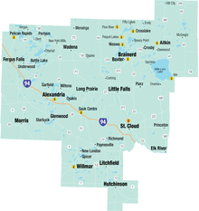
Central Minnesota is the central part of the state of Minnesota. No definitive boundaries of the region exist, but most definitions would include the land north of Interstate 94, east of U.S. Highway 59, south of U.S. Highway 2, and west of U.S. Highway 169.
Previous Page Next Page


