Our website is made possible by displaying online advertisements to our visitors.
Please consider supporting us by disabling your ad blocker.
Champneuf
Champneuf | |
|---|---|
 | |
 Location within Abitibi RCM | |
| Coordinates: 48°35′N 77°30′W / 48.583°N 77.500°W[1] | |
| Country | Canada |
| Province | Quebec |
| Region | Abitibi-Témiscamingue |
| RCM | Abitibi |
| Settled | 1938 |
| Constituted | January 1, 1964 |
| Government | |
| • Mayor | Rosaire Guénette |
| • Federal riding | Abitibi—Témiscamingue |
| • Prov. riding | Abitibi-Ouest |
| Area | |
• Total | 242.73 km2 (93.72 sq mi) |
| • Land | 241.32 km2 (93.17 sq mi) |
| Population (2021)[3] | |
• Total | 94 |
| • Density | 0.4/km2 (1/sq mi) |
| • Pop (2016-21) | |
| • Dwellings | 54 |
| Time zone | UTC−05:00 (EST) |
| • Summer (DST) | UTC−04:00 (EDT) |
| Postal code(s) | |
| Area code | 819 |
| Highways | No major routes |
| Website | www |
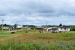
Champneuf (French pronunciation: [ʃɑ̃nœf]) is a municipality in the Canadian province of Quebec, located in the Abitibi Regional County Municipality. It is the least populated incorporated place in the Abitibi-Témiscamingue region.
- ^ Cite error: The named reference
toponymiewas invoked but never defined (see the help page). - ^ a b "Champneuf". Répertoire des municipalités (in French). Ministère des Affaires municipales et de l'Habitation. Retrieved 2023-07-23.
- ^ a b Cite error: The named reference
SC21was invoked but never defined (see the help page).
Previous Page Next Page


