Our website is made possible by displaying online advertisements to our visitors.
Please consider supporting us by disabling your ad blocker.
Cheam
| Cheam | |
|---|---|
|
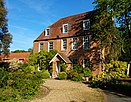
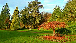
Top to bottom, left to right: Grade II listed Nonsuch Mansion in Nonsuch Park; The Old Rectory, Cheam; Whitehall during Cheam Charter Fair; Nonsuch Park | |
Location within Greater London | |
| Population | 10,285 (2011 Census. Ward)[1] |
| OS grid reference | TQ245625 |
| London borough | |
| Ceremonial county | Greater London |
| Region | |
| Country | England |
| Sovereign state | United Kingdom |
| Post town | SUTTON |
| Postcode district | SM2, SM3 |
| Dialling code | 020 |
| Police | Metropolitan |
| Fire | London |
| Ambulance | London |
| UK Parliament | |
| London Assembly | |
Cheam (/ˈtʃiːm/) is a suburb of London, England, 10.9 miles (17.5 km) southwest of Charing Cross. It is divided into North Cheam, Cheam Village and South Cheam. Cheam Village contains the listed buildings Lumley Chapel and the 16th-century Whitehall. It is adjacent to two large parks, Nonsuch Park and Cheam Park. Nonsuch Park contains the listed Nonsuch Mansion. Parts of Cheam Park and Cheam Village are in a conservation area. Cheam is bordered by Worcester Park to the northwest, Morden to the northeast, Sutton to the east, Epsom, Ewell and Stoneleigh to the west and Banstead and Belmont to the south.
- ^ "Sutton Ward population 2011". Neighbourhood Statistics. Office for National Statistics. Archived from the original on 21 October 2016. Retrieved 9 October 2016.
Previous Page Next Page


