Our website is made possible by displaying online advertisements to our visitors.
Please consider supporting us by disabling your ad blocker.
Cher (department)
You can help expand this article with text translated from the corresponding article in French. (January 2009) Click [show] for important translation instructions.
|
Cher
Char | |
|---|---|
 Prefecture building in Bourges | |
|
| |
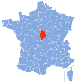
 Location of Cher in France | |
| Coordinates: 47°0′N 2°35′E / 47.000°N 2.583°E | |
| Country | France |
| Region | Centre-Val de Loire |
| Prefecture | Bourges |
| Subprefectures | Saint-Amand-Montrond Vierzon |
| Government | |
| • President of the Departmental Council | Jacques Fleury[1] (LR) |
| Area | |
• Total | 7,235 km2 (2,793 sq mi) |
| Population (2021)[2] | |
• Total | 299,573 |
| • Rank | 76th |
| • Density | 41/km2 (110/sq mi) |
| Time zone | UTC+1 (CET) |
| • Summer (DST) | UTC+2 (CEST) |
| Department number | 18 |
| Arrondissements | 3 |
| Cantons | 19 |
| Communes | 287 |
| ^1 French Land Register data, which exclude estuaries and lakes, ponds and glaciers larger than 1 km2 | |
Cher (/ʃɛər/ SHAIR, French: [ʃɛʁ] ⓘ; Berrichon: Char) is a department in central France, part of the Centre-Val de Loire region. Named after the river Cher, its prefecture is Bourges. In 2019, it had a population of 302,306.[3]
- ^ "Répertoire national des élus: les conseillers départementaux". data.gouv.fr, Plateforme ouverte des données publiques françaises (in French). 4 May 2022.
- ^ "Téléchargement du fichier d'ensemble des populations légales en 2021" (in French). The National Institute of Statistics and Economic Studies. 28 December 2023.
- ^ Populations légales 2019: 18 Cher, INSEE
Previous Page Next Page


