Our website is made possible by displaying online advertisements to our visitors.
Please consider supporting us by disabling your ad blocker.
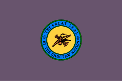
Choctaw Nation of Oklahoma
Choctaw Nation
Chahta Okla (Choctaw) Choctaw Nation of Oklahoma | |
|---|---|
| Motto(s): | |
| Anthem: ("Nahata Fichik Tohwikeli"[2] and "Antvt bilia" used for some occasions) | |
 Location (red) in the U.S. state of Oklahoma | |
| Recognized | January 3, 1786 (Treaty) |
| Established | September 27, 1830 (Treaty) |
| Expansions | 1843–1855 |
| Reductions | 1855–1867 |
| Constitution | January 11, 1860 |
| Annexed by the U.S. | June 16, 1906 |
| Self-determination | 1971 |
| Reservation Reconstituted | July 9, 2020 |
| Capital | Durant (de facto) Tuskahoma (de jure) |
| Subdivisions | 12 Districts |
| Government | |
| • Type | Republic |
| • Body | Choctaw Nation Council |
| • Chief | Gary Batton (R) |
| • Assistant Chief | Jack Austin, Jr. (R) |
| • Speaker of the Choctaw Council | Thomas Williston |
| • Chief Justice | David Burrage |
| • U.S. House Delegate-designee | Vacant |
| Area | |
• Total | 28,140 km2 (10,864 sq mi) |
| Population (2020)[3] | |
• Total | 226,984 |
| • Density | 8.1/km2 (21/sq mi) |
| 48,000 Choctaw/Nat. Am. 185,126 White and other | |
| Demonym | Choctaw |
| Time zone | UTC−06:00 (CST) |
| • Summer (DST) | UTC−05:00 (CDT) |
| Website | choctawnation |
 | |
| Total population | |
|---|---|
| 223,279 total enrollment, 84,670 enrolled in Oklahoma[4] | |
| Regions with significant populations | |
| United States (Oklahoma) | |
| Languages | |
| English, Choctaw | |
| Religion | |
| Evangelical Protestantism | |
| Related ethnic groups | |
| other Choctaw bands, Chickasaw |
The Choctaw Nation of Oklahoma (Choctaw: Chahta Okla) is a Native American reservation[5] occupying portions of southeastern Oklahoma in the United States.[6] At roughly 6,952,960 acres (28,138 km2; 10,864 sq mi), it is the second-largest reservation in area after the Navajo, exceeding that of the seven smallest U.S. states.[which?] The seat of government is located in Durant, Oklahoma.
As of 2011, the tribe has 223,279 enrolled members, of whom 84,670 live within the state of Oklahoma[7] and 41,616 live within the Choctaw Nation's jurisdiction.[8] A total of 233,126 people live within these boundaries, with its tribal jurisdictional area comprising 10.5 counties in the state.
The Choctaw Nation is the third-largest federally recognized tribe in the United States, and shares borders with the reservations of the Chickasaw, Muscogee, and Cherokee, as well as the U.S. states of Texas and Arkansas. The original territory has expanded and shrunk several times since the 19th century, reaching its current boundaries in 1867.
- ^ Tribal Council approves Official Choctaw Flag Salute
- ^ The Star Spangled Banner – Nahata Fichik Tohwikeli – Choctaw
- ^ "2020 Census Results: NCAI Eastern Oklahoma and Southern Plains Region Tribal Land Data" (PDF). Retrieved June 3, 2022.
- ^ "2011 Oklahoma Indian Nations Pocket Pictorial Directory" (PDF). Oklahoma Indian Affairs Commission. September 2011. Archived from the original (PDF) on October 27, 2011. Retrieved December 31, 2011.
- ^ "History". www.choctawnation.com/. Retrieved 2020-09-03.
- ^ "Annual Report of the Secretary of the Interior for the Fiscal Year". 1916.
- ^ "2011 Oklahoma Indian Nations Pocket Pictorial Directory" (PDF). Archived from the original (PDF) on 2012-05-12. Retrieved 2020-07-11.
- ^ http://www.odot.org/OK-GOV-DOCS/PROGRAMS-AND-PROJECTS/GRANTS/FASTLANE-US69/Reports-Tech-Info/Tribal%20Data.pdf [bare URL PDF]
Previous Page Next Page


