Our website is made possible by displaying online advertisements to our visitors.
Please consider supporting us by disabling your ad blocker.
Cirencester
This article needs additional citations for verification. (June 2021) |
| Cirencester | |
|---|---|
| Market town | |
 | |
Location within Gloucestershire | |
| Population | 20,229 (2021 Census)[1] |
| OS grid reference | SP022021 |
| District | |
| Shire county | |
| Region | |
| Country | England |
| Sovereign state | United Kingdom |
| Post town | CIRENCESTER |
| Postcode district | GL7 |
| Dialling code | 01285 |
| Police | Gloucestershire |
| Fire | Gloucestershire |
| Ambulance | South Western |
| UK Parliament | |
| Website | Town Council |
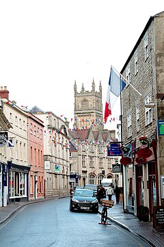
Cirencester (/ˈsaɪrənsɛstər/ ⓘ SY-rən-sest-ər, occasionally /ˈsɪstər/ ⓘ SIST-ər; see below for more variations)[2] is a market town and civil parish in the Cotswold District of Gloucestershire, England. Cirencester lies on the River Churn, a tributary of the River Thames. It is the eighth largest settlement in Gloucestershire and the largest town within the Cotswolds. It is the home of the Royal Agricultural University, the oldest agricultural college in the English-speaking world, founded in 1840. The town had a population of 20,229 in 2021.[1] The town is 18 miles (29 km) northwest of Swindon, 18 miles (29 km) southeast of Gloucester, 37 miles (60 km) west of Oxford and 39 miles (63 km) northeast of Bristol.
The Roman name for the town was Corinium, which is thought to have been associated with the ancient British tribe of the Dobunni, having the same root word as the River Churn.[3] The earliest known reference to the town was by Ptolemy in AD 150. The town's Corinium Museum has an extensive Roman collection.
Cirencester is twinned with the town of Itzehoe, in the Steinburg region of Germany.[4]
- ^ a b "Cirencester". City population. Retrieved 25 October 2022.
- ^ Room, Adrian, The Pronunciation of Placenames: A Worldwide Dictionary Archived 17 February 2017 at the Wayback Machine, McFarland, 2007, pages 6 & 51
- ^ "Cirencester History Summary". Cirencester.co.uk. Archived from the original on 14 November 2013. Retrieved 3 March 2011.
- ^ "Town Council – Twinning with Itzehoe". Cirencester.gov.uk. Archived from the original on 30 July 2012. Retrieved 3 March 2011.
Previous Page Next Page


