Our website is made possible by displaying online advertisements to our visitors.
Please consider supporting us by disabling your ad blocker.
Citico Creek Wilderness
| Citico Creek Wilderness | |
|---|---|
 | |
 | |
| Location | Monroe County, Tennessee, USA |
| Nearest city | Tapoco, North Carolina |
| Coordinates | 35°24′17″N 84°03′02″W / 35.40472°N 84.05056°W |
| Area | 16,226 acres (66 km2) |
| Established | 1984 |
| Governing body | U.S. Forest Service |
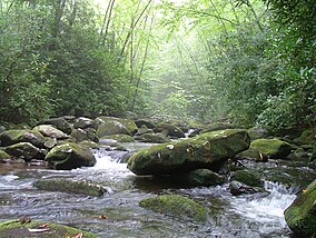
Citico Creek Wilderness is a 16,226-acre (66 km2) wilderness area within the Cherokee National Forest in the U.S. state of Tennessee. The wilderness contains the entire upper drainage of Citico Creek, which consists of the north and south forks and at least eight tributaries. Three steep-sided ridges descend west from the crest of the Unicoi Mountains — Brush Mountain, Pine Ridge, and Sassafras Ridge.[1]
- ^ Citico CreekWilderness - Wilderness.net
Previous Page Next Page


