Our website is made possible by displaying online advertisements to our visitors.
Please consider supporting us by disabling your ad blocker.
Collins Park (Bayonne, New Jersey)
| Collins Park | |
|---|---|
 Bayonne Bridge from Collins Park | |
| Location | Bayonne, New Jersey |
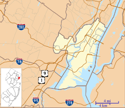
| Coordinates | 40°38′43″N 74°07′31″W / 40.64529°N 74.12536°W |
| Area | 40 acres |
Collins Park, or 1st Street Park, is the largest municipal park in Bayonne, New Jersey. It is located at the southern end of the city and runs for 0.75 miles (1.21 km) along the shore the Kill van Kull.[1] Once known as Kill van Kull Park, it is named for Dennis P. Collins, who served at mayor of Bayonne from 1974 to 1990. The approach to the Bayonne Bridge crosses over the park at the west, under which will connect to the planned extension of Hackensack River Greenway at Bergen Point.[2]
- ^ "Municipal Public Access Plan" (PDF). www.nj.gov. 2018. Retrieved August 3, 2022.
An extensive waterfront park along Bayonne's southern shoreline, the park starts under Bayonne Bridge and runs east for 0.75 miles. Built in the 1950s, the park provides opportunities for both passive and active recreation. On the western end of the park, there exists a dock that gives the public access to the Kill Van Kull. The park is the southern-most terminus of the Hudson River Walkway...
- ^ Hudson County Planning Board (February 15, 2022). "Hackensack River Greenway" (PDF). www.hcnj.us. Retrieved October 16, 2022.
Previous Page Next Page


