Our website is made possible by displaying online advertisements to our visitors.
Please consider supporting us by disabling your ad blocker.
Como, New South Wales
| Como Sydney, New South Wales | |||||||||||||||
|---|---|---|---|---|---|---|---|---|---|---|---|---|---|---|---|
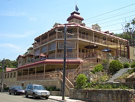
 Como Hotel | |||||||||||||||
 | |||||||||||||||
| Population | 4,053 (2021 census)[1] | ||||||||||||||
| Established | 1883 | ||||||||||||||
| Postcode(s) | 2226 | ||||||||||||||
| Elevation | 31 m (102 ft) | ||||||||||||||
| Location | 27 km (17 mi) south of Sydney CBD | ||||||||||||||
| LGA(s) | Sutherland Shire | ||||||||||||||
| State electorate(s) | Miranda | ||||||||||||||
| Federal division(s) | Hughes | ||||||||||||||
| |||||||||||||||
Como is a suburb in southern Sydney, located on the southern banks of the Georges River, in the state of New South Wales, Australia. It is located 27 kilometres (17 mi) south of the Sydney central business district in the local government area of the Sutherland Shire. The postcode is 2226, which it shares with neighbouring suburbs Jannali, Bonnet Bay and Como West. The postal locality (suburb) of Como West was originally created in 1939 from within the greater Como locality and is bounded to the west by the Woronora River. The shoreline across Como features Bonnet Bay, Scylla Bay and Carina Bay.
- ^ Australian Bureau of Statistics (28 June 2022). "Como (NSW) (State Suburb)". 2021 Census QuickStats. Retrieved 9 August 2024.
Previous Page Next Page


