Our website is made possible by displaying online advertisements to our visitors.
Please consider supporting us by disabling your ad blocker.
Crescentwood, Winnipeg
This article needs additional citations for verification. (July 2013) |
Crescentwood | |
|---|---|
Neighbourhood | |
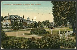
 Residential Crescentwood c. 1912 | |
 | |
| Coordinates: 49°52′02″N 97°09′45″W / 49.86722°N 97.16250°W | |
| Original development | 1904 |
| Founded by | C. H. Enderton |
| Area | |
• Total | 1.1 km2 (0.4 sq mi) |
| Population (2021) | |
• Total | 2,925 |
Crescentwood is a neighbourhood in the River Heights area of Winnipeg, Manitoba, Canada. It is bordered on the north by Academy Road, on the east by the Assiniboine River, on the south by Corydon Avenue, and on the west by Cambridge Street.
Previous Page Next Page


